File:Canada Alberta location map 2.svg
File:Canada Alberta location map 2.svg
Jump to navigation
Jump to search
- File
- File history
- File usage
- Global file usage
- Metadata
Size of this PNG preview of this SVG file: 486 × 599 pixels. Other resolutions: 195 × 240 pixels | 389 × 480 pixels | 487 × 600 pixels | 623 × 768 pixels | 831 × 1,024 pixels | 1,512 × 1,863 pixels.
Original file (SVG file, nominally 1,512 × 1,863 pixels, file size: 736 KB)
| This is a file from the Wikimedia Commons. Information from its description page there is shown below. Commons is a freely licensed media file repository. You can help. |
| DescriptionCanada Alberta location map 2.svg | Deutsch: Positionskarte von Alberta, Kanada Quadratische Plattkarte, N-S-Streckung 170 %. Geographische Begrenzung der Karte:
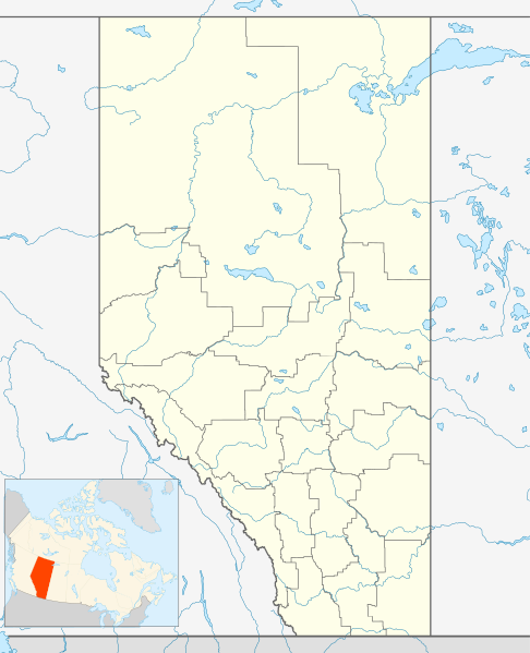
English: Location map of Alberta, Canada, showing the 19 census divisions. Equirectangular projection, N/S stretching 170%. Geographic limits of the map:
Español: Divisiones censales de Alberta Français : Les divisions de recensement de l'Alberta Italiano: Divisioni censuarie dell'Alberta | |||||
| Date | 24 September 2009 | |||||
| Source | Own work, File:Canada Alberta location map.svg by NordNordWest | |||||
| Author | Hanhil (talk) 05:35, 24 September 2009 (UTC) | |||||
| Permission (Reusing this file) | I, the copyright holder of this work, hereby publish it under the following license:
|
File history
Click on a date/time to view the file as it appeared at that time.
| Date/Time | Thumbnail | Dimensions | User | Comment | |
|---|---|---|---|---|---|
| current | 05:35, 24 September 2009 |  | 1,512 × 1,863 (736 KB) | Hanhil | {{Information |Description= {{de|Positionskarte von Alberta, Kanada}} Quadratische Plattkarte, N-S-Streckung 170 %. Geographische Begrenzung der Karte: * N: 60.3° N * S: 48.7° N * W: 123.0° W * O: 107.0° W {{en|Location |
File usage
More than 100 pages use this file.
The following list shows the first 100 pages that use this file only.
A full list is available.
- Airdrie, Alberta
- Athabasca, Alberta
- Athabasca Falls
- Banff, Alberta
- Banff National Park
- Barrhead, Alberta
- Bassano, Alberta
- Bawlf
- Beiseker
- Black Diamond, Alberta
- Bon Accord, Alberta
- Bonnyville
- Bow Falls
- Bowden, Alberta
- Bragg Creek
- British Army Training Unit Suffield
- CFB Suffield
- Calgary/Springbank Airport
- Calgary International Airport
- Camrose, Alberta
- Canmore, Alberta
- Cardston
- Carstairs, Alberta
- Castle Junction
- Castor, Alberta
- Chateau Lake Louise
- Coaldale, Alberta
- Cochrane, Alberta
- Cold Lake, Alberta
- Consort, Alberta
- Coronation, Alberta
- Crowsnest Pass, Alberta
- Didsbury, Alberta
- Dinosaur Provincial Park
- Drayton Valley
- Drumheller
- Edmonton
- Edmonton International Airport
- Edson, Alberta
- Elk Point, Alberta
- Elkwater, Alberta
- Exshaw
- Fairview, Alberta
- Forestburg, Alberta
- Fort Chipewyan
- Fort Macleod
- Fort Saskatchewan
- Fort Whoop-Up
- Frank, Alberta
- Grand Centre, Alberta
- Grande Prairie
- Hanna, Alberta
- Head-Smashed-In Buffalo Jump
- High Level
- Hinton, Alberta
- Irricana
- Irvine, Alberta
- Jasper National Park
- Lac La Biche, Alberta
- Lacombe, Alberta
- Lake Louise, Alberta
- Leduc, Alberta
- Lethbridge
- Ma-Me-O Beach
- Magrath
- Manning, Alberta
- Mayerthorpe
- Medicine Hat
- Milk River, Alberta
- New Norway
- Ohaton
- Okotoks
- Olds, Alberta
- Oyen
- Penhold
- Picture Butte
- Pincher Creek
- Red Deer, Alberta
- Redcliff, Alberta
- Rochfort Bridge
- Seven Persons
- Sexsmith, Alberta
- Spruce Grove
- St. Paul, Alberta
- Stettler, Alberta
- Stony Plain, Alberta
- Strathmore, Alberta
- Sundre
- Sunwapta Falls
- Sylvan Lake, Alberta
- Tawatinaw
- Turner Valley
- Vegreville
- Vermilion, Alberta
- Viking, Alberta
- Vulcan, Alberta
- Wainwright, Alberta
- Wetaskiwin
- Whitecourt
- Willmore Wilderness Park
Global file usage
The following other wikis use this file:
- Usage on ar.wikipedia.org
- قالب:صندوق معلومات منطقة محمية/شرح
- قالب:صندوق معلومات منطقة محمية
- أنزاك (ألبرتا)
- كونكلن (ألبرتا)
- فورت تشيبوايان (ألبرتا)
- فورت ماكاي (ألبرتا)
- غريغوار لايك (ألبرتا)
- سابري كريك (ألبرتا)
- درابر (ألبرتا)
- فورت فيتزجيرالد (ألبرتا)
- ماريانا لايك (ألبرتا)
- قالب:صندوق معلومات منطقة محمية/ملعب
- Usage on ast.wikipedia.org
- Aeropuertu Internacional de Calgary
- Aeropuertu Internacional d'Edmonton
- Usage on az.wikipedia.org
- Letbric
- Usage on ba.wikipedia.org
- Ҡалып:ПозКарта Альберта
- Usage on bg.wikipedia.org
- Шаблон:ПК Канада Албърта
- Usage on bs.wikipedia.org
- Biatlon na Zimskim olimpijskim igrama 1988.
- Šablon:Lokacijska karta Alberta
- Usage on ceb.wikipedia.org
- Plantilya:Geobox locator Alberta
- Usage on ch.wikipedia.org
- Muna'sesetbi:Philip J/Sandbox 3
- Usage on cs.wikipedia.org
- Canmore
- Usage on eo.wikipedia.org
- Kalgario
- Edmontono
- Red Deer
- Lethbridge
- Medicine Hat
- Airdrie
- Strathmore
- Okotoks
- Banff
- Drumheller
- Brooks
- Cold Lake
- Leduc
- Grande Prairie
- Chestermere
- Camrose
- Cochrane
- Canmore
- Beltline
- St. Albert
- Spruce Grove
- Jasper (Alberto)
- Eau Claire
- Cremona (Kanado)
- Bowness
- Inglewood
- Acadia
- Ŝablono:Geokesto lokumilo Alberto
View more global usage of this file.
Metadata
(window.RLQ=window.RLQ||).push(function(){mw.config.set({"wgBackendResponseTime":251,"wgHostname":"mw1274"});});


