Lane Cove West
Lane Cove West
Jump to navigation
Jump to search
Lane Cove West Sydney, New South Wales | |||||||||||||||
|---|---|---|---|---|---|---|---|---|---|---|---|---|---|---|---|
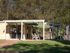 Lane Cove West Tennis Club | |||||||||||||||
| Population | 2,637 (2016 census)[1] | ||||||||||||||
| Postcode(s) | 2066 | ||||||||||||||
| Location | 9 km (6 mi) north-west of Sydney CBD | ||||||||||||||
| LGA(s) | Municipality of Lane Cove | ||||||||||||||
| State electorate(s) | Lane Cove | ||||||||||||||
| Federal Division(s) | North Sydney | ||||||||||||||
| |||||||||||||||
Lane Cove West is a suburb on the Lower North Shore of Sydney, in the state of New South Wales, Australia. Lane Cove West is located 9 kilometres north-west of the Sydney central business district, in the local government area of the Municipality of Lane Cove. Lane Cove and Lane Cove North are separate suburbs.
Contents
1 History
2 Population
3 Commercial area
4 Parks and recreation
5 References
6 External links
History[edit]
The land in the area was originally used for agriculture and owned by John Blackman. From the mid-1950s Lane Cove West was home to the national head office, pressing plant, warehouse and recording studios of the Warner Bros. Records label Festival Mushroom Records. Lane Cove West Public School was also built at this time.
Lane Cove West split off from Lane Cove to become a separate suburb on 6 September 2002.[2]
Population[edit]
In the 2016 Census, there were 2,637 people in Lane Cove West. 62.7% of people were born in Australia. The most common countries of birth were England 5.4% and China 3.8%. 74.0% of people only spoke English at home. The most common responses for religion were Catholic 30.6%, No Religion 27.3% and Anglican 15.2%.[1]
Commercial area[edit]
Lane Cove West Business Park is an industrial area with factories and warehouses of such companies as Nestle, Macquarie Goodman, Wicked Foods and Lego. Most are located on Sam Johnson Way (Orion Rd) and Mars Road.
There are also a number of small businesses situated at Figtree Plaza on Cullen Street and Burns Bay Road. These include a hair salon, cafe, beautician, fish and chip shop, fruit and vegetable market, newsagent, bakery and a butcher shop. Close by is the Metropolitan Baptist Church.
Parks and recreation[edit]
Blackman Park is situated on the Lane Cove River and was originally a small valley used for landfill. It features a number of recreation facilities including tennis courts at the Lane Cove West Tennis Club, cricket pitches, bike tracks, basketball court, skate park and bush walking tracks. Smaller reserves include Cullen St Reserve, Henley Reserve, Penrose St Park, Garthowen St Cricket Nets and Epping Road Reserve. There is also a lawn bowls club, Lane Cove Bowling Club (formerly called Lane Cove West Bowling Club).

Blackman Park

References[edit]
^ ab Australian Bureau of Statistics (27 June 2017). "Lane Cove West (State Suburb)". 2016 Census QuickStats. Retrieved 8 November 2017..mw-parser-output cite.citation{font-style:inherit}.mw-parser-output .citation q{quotes:"""""""'""'"}.mw-parser-output .citation .cs1-lock-free a{background:url("//upload.wikimedia.org/wikipedia/commons/thumb/6/65/Lock-green.svg/9px-Lock-green.svg.png")no-repeat;background-position:right .1em center}.mw-parser-output .citation .cs1-lock-limited a,.mw-parser-output .citation .cs1-lock-registration a{background:url("//upload.wikimedia.org/wikipedia/commons/thumb/d/d6/Lock-gray-alt-2.svg/9px-Lock-gray-alt-2.svg.png")no-repeat;background-position:right .1em center}.mw-parser-output .citation .cs1-lock-subscription a{background:url("//upload.wikimedia.org/wikipedia/commons/thumb/a/aa/Lock-red-alt-2.svg/9px-Lock-red-alt-2.svg.png")no-repeat;background-position:right .1em center}.mw-parser-output .cs1-subscription,.mw-parser-output .cs1-registration{color:#555}.mw-parser-output .cs1-subscription span,.mw-parser-output .cs1-registration span{border-bottom:1px dotted;cursor:help}.mw-parser-output .cs1-ws-icon a{background:url("//upload.wikimedia.org/wikipedia/commons/thumb/4/4c/Wikisource-logo.svg/12px-Wikisource-logo.svg.png")no-repeat;background-position:right .1em center}.mw-parser-output code.cs1-code{color:inherit;background:inherit;border:inherit;padding:inherit}.mw-parser-output .cs1-hidden-error{display:none;font-size:100%}.mw-parser-output .cs1-visible-error{font-size:100%}.mw-parser-output .cs1-maint{display:none;color:#33aa33;margin-left:0.3em}.mw-parser-output .cs1-subscription,.mw-parser-output .cs1-registration,.mw-parser-output .cs1-format{font-size:95%}.mw-parser-output .cs1-kern-left,.mw-parser-output .cs1-kern-wl-left{padding-left:0.2em}.mw-parser-output .cs1-kern-right,.mw-parser-output .cs1-kern-wl-right{padding-right:0.2em}

^ "Lane Cove West". Geographical Names Register (GNR) of NSW. Geographical Names Board of New South Wales. Retrieved 19 June 2014.
External links[edit]
Lane Cove at Curlie
| Wikimedia Commons has media related to Lane Cove West, New South Wales. |
Coordinates: 33°48′43″S 151°09′00″E / 33.812°S 151.150°E / -33.812; 151.150
Categories:
- Suburbs of Sydney
(window.RLQ=window.RLQ||).push(function(){mw.config.set({"wgPageParseReport":{"limitreport":{"cputime":"0.312","walltime":"0.412","ppvisitednodes":{"value":1572,"limit":1000000},"ppgeneratednodes":{"value":0,"limit":1500000},"postexpandincludesize":{"value":34371,"limit":2097152},"templateargumentsize":{"value":3228,"limit":2097152},"expansiondepth":{"value":12,"limit":40},"expensivefunctioncount":{"value":5,"limit":500},"unstrip-depth":{"value":1,"limit":20},"unstrip-size":{"value":8085,"limit":5000000},"entityaccesscount":{"value":1,"limit":400},"timingprofile":["100.00% 378.837 1 -total"," 37.02% 140.238 1 Template:Reflist"," 35.62% 134.955 1 Template:Infobox_Australian_place"," 31.32% 118.663 1 Template:Census_2016_AUS"," 23.37% 88.539 2 Template:Cite_web"," 19.14% 72.522 1 Template:Infobox"," 10.50% 39.769 1 Template:Short_description"," 9.64% 36.516 1 Template:Commons_category"," 8.61% 32.625 1 Template:Pagetype"," 7.47% 28.306 1 Template:Use_dmy_dates"]},"scribunto":{"limitreport-timeusage":{"value":"0.158","limit":"10.000"},"limitreport-memusage":{"value":3892648,"limit":52428800}},"cachereport":{"origin":"mw1269","timestamp":"20190401150136","ttl":2592000,"transientcontent":false}}});});{"@context":"https://schema.org","@type":"Article","name":"Lane Cove West","url":"https://en.wikipedia.org/wiki/Lane_Cove_West","sameAs":"http://www.wikidata.org/entity/Q6485381","mainEntity":"http://www.wikidata.org/entity/Q6485381","author":{"@type":"Organization","name":"Contributors to Wikimedia projects"},"publisher":{"@type":"Organization","name":"Wikimedia Foundation, Inc.","logo":{"@type":"ImageObject","url":"https://www.wikimedia.org/static/images/wmf-hor-googpub.png"}},"datePublished":"2005-09-28T02:56:33Z","dateModified":"2019-02-06T04:21:35Z","image":"https://upload.wikimedia.org/wikipedia/commons/a/a3/Lane_Cove_West_Tennis_Club.JPG","headline":"suburb of Sydney, New South Wales, Australia"}(window.RLQ=window.RLQ||).push(function(){mw.config.set({"wgBackendResponseTime":114,"wgHostname":"mw1243"});});


