National Register of Historic Places listings in Iowa
National Register of Historic Places listings in Iowa
Jump to navigation
Jump to search

Iowa counties (clickable)
This is a list of properties and historic districts in Iowa that are listed on the National Register of Historic Places. There are listings in all of Iowa's 99 counties, adding up to over 2,300 total.
Adair | Adams | Allamakee | Appanoose | Audubon | Benton | Black Hawk | Boone | Bremer | Buchanan | Buena Vista | Butler | Calhoun | Carroll | Cass | Cedar | Cerro Gordo | Cherokee | Chickasaw | Clarke | Clay | Clayton | Clinton | Crawford | Dallas | Davis | Decatur | Delaware | Des Moines | Dickinson | Dubuque | Emmet | Fayette | Floyd | Franklin | Fremont | Greene | Grundy | Guthrie | Hamilton | Hancock | Hardin | Harrison | Henry | Howard | Humboldt | Ida | Iowa | Jackson | Jasper | Jefferson | Johnson | Jones | Keokuk | Kossuth | Lee | Linn | Louisa | Lucas | Lyon | Madison | Mahaska | Marion | Marshall | Mills | Mitchell | Monona | Monroe | Montgomery | Muscatine | O'Brien | Osceola | Page | Palo Alto | Plymouth | Pocahontas | Polk | Pottawattamie | Poweshiek | Ringgold | Sac | Scott | Shelby | Sioux | Story | Tama | Taylor | Union | Van Buren | Wapello | Warren | Washington | Wayne | Webster | Winnebago | Winneshiek | Woodbury | Worth | Wright |
This National Park Service list is complete through NPS recent listings posted April 12, 2019.[1]
Current listings by county[edit]
The following are approximate tallies of current listings by county. These counts are based on entries in the National Register Information Database as of April 24, 2008[2] and new weekly listings posted since then on the National Register of Historic Places web site.[3] There are frequent additions to the listings and occasional delistings and the counts here are approximate and not official. New entries are added to the official Register on a weekly basis.[4] Also, the counts in this table exclude boundary increase and decrease listings which modify the area covered by an existing property or district and which carry a separate National Register reference number. The numbers of NRHP listings in each county are documented by tables in each of the individual county list-articles.

Phil Hoffman House, in Mahaska County

Snake Alley, in Des Moines County
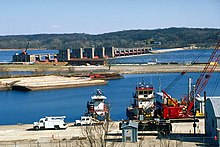
Lock and Dam No. 14 Historic District, in Scott County

Grotto of the Redemption, in Palo Alto County
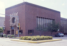
Merchants' National Bank in Poweshiek County, designed by Louis Sullivan

Howes Building, in Clinton County

Fourth Street Historic District, in Woodbury County
County | # of Sites | |
|---|---|---|
| 1 | Adair | 9 |
| 2 | Adams | 5 |
| 3 | Allamakee | 22 |
| 4 | Appanoose | 13 |
| 5 | Audubon | 15 |
| 6 | Benton | 16 |
| 7 | Black Hawk | 48 |
| 8 | Boone | 18 |
| 9 | Bremer | 12 |
| 10 | Buchanan | 20 |
| 11 | Buena Vista | 10 |
| 12 | Butler | 7 |
| 13 | Calhoun | 12 |
| 14 | Carroll | 14 |
| 15 | Cass | 11 |
| 16 | Cedar | 17 |
| 17 | Cerro Gordo | 45 |
| 18 | Cherokee | 9 |
| 19 | Chickasaw | 4 |
| 20 | Clarke | 8 |
| 21 | Clay | 9 |
| 22 | Clayton | 55 |
| 23 | Clinton | 30 |
| 24 | Crawford | 14 |
| 25 | Dallas | 15 |
| 26 | Davis | 12 |
| 27 | Decatur | 7 |
| 28 | Delaware | 14 |
| 29 | Des Moines | 32 |
| 30 | Dickinson | 12 |
| 31 | Dubuque | 83 |
| 32 | Emmet | 3 |
| 33 | Fayette | 29 |
| 34 | Floyd | 20 |
| 35 | Franklin | 12 |
| 36 | Fremont | 9 |
| 37 | Greene | 17 |
| 38 | Grundy | 2 |
| 39 | Guthrie | 8 |
| 40 | Hamilton | 8 |
| 41 | Hancock | 9 |
| 42 | Hardin | 35 |
| 43 | Harrison | 13 |
| 44 | Henry | 51 |
| 45 | Howard | 8 |
| 46 | Humboldt | 7 |
| 47 | Ida | 5 |
| 48 | Iowa | 11 |
| 49 | Jackson | 75 |
| 50 | Jasper | 14 |
| 51 | Jefferson | 29 |
| 52 | Johnson | 90 |
| 53 | Jones | 29 |
| 54 | Keokuk | 10 |
| 55 | Kossuth | 6 |
| 56 | Lee | 45 |
| 57 | Linn | 99 |
| 58 | Louisa | 8 |
| 59 | Lucas | 16 |
| 60 | Lyon | 10 |
| 61 | Madison | 50 |
| 62 | Mahaska | 47 |
| 63 | Marion | 27 |
| 64 | Marshall | 15 |
| 65 | Mills | 6 |
| 66 | Mitchell | 10 |
| 67 | Monona | 10 |
| 68 | Monroe | 11 |
| 69 | Montgomery | 18 |
| 70 | Muscatine | 32 |
| 71 | O'Brien | 3 |
| 72 | Osceola | 1 |
| 73 | Page | 9 |
| 74 | Palo Alto | 4 |
| 75 | Plymouth | 12 |
| 76 | Pocahontas | 3 |
| 77 | Polk | 190 |
| 78 | Pottawattamie | 38 |
| 79 | Poweshiek | 24 |
| 80 | Ringgold | 6 |
| 81 | Sac | 13 |
| 82.1 | Scott: Davenport: Downtown | 54 |
| 82.2 | Scott: Davenport: East | 90 |
| 82.3 | Scott: Davenport: West | 109 |
| 82.4 | Scott: Davenport: Duplicates | (1)[5] |
| 82.5 | Scott: Other | 31 |
| 82.6 | Scott: Total | 283 |
| 83 | Shelby | 12 |
| 84 | Sioux | 4 |
| 85 | Story | 36 |
| 86 | Tama | 12 |
| 87 | Taylor | 7 |
| 88 | Union | 6 |
| 89 | Van Buren | 19 |
| 90 | Wapello | 30 |
| 91 | Warren | 13 |
| 92 | Washington | 19 |
| 93 | Wayne | 3 |
| 94 | Webster | 14 |
| 95 | Winnebago | 3 |
| 96 | Winneshiek | 32 |
| 97 | Woodbury | 56 |
| 98 | Worth | 6 |
| 99 | Wright | 9 |
| (duplicates) | (4)[6] | |
| Total: | 2,367 | |
Adair County[edit]
Adams County[edit]
| [7] | Name on the Register | Image | Date listed[8] | Location | City or town | Description |
|---|---|---|---|---|---|---|
1 | Adams County Jail |  | February 28, 1991 (#91000119) | 1000 Benton Ave. 40°59′32″N 94°44′04″W / 40.992222°N 94.734444°W / 40.992222; -94.734444 (Adams County Jail) | Corning | |
2 | Corning Commercial Historic District |  | May 31, 2012 (#12000318) | 513-824 Davis Ave., 701-829 Benton Ave. & cross streets 40°59′21″N 94°44′05″W / 40.989066°N 94.734809°W / 40.989066; -94.734809 (Corning Commercial Historic District) | Corning | |
3 | Corning Opera House | September 21, 1993 (#93000954) | 800 Davis Ave. 40°59′25″N 94°44′01″W / 40.990278°N 94.733611°W / 40.990278; -94.733611 (Corning Opera House) | Corning | ||
4 | Noah Odell House |  | November 30, 2000 (#00000917) | 1245 240th St. 40°57′35″N 94°50′45″W / 40.959722°N 94.845833°W / 40.959722; -94.845833 (Noah Odell House) | Nodaway | |
5 | Snider Bridge |  | June 25, 1998 (#98000774) | 220th St. over an unnamed stream 40°59′28″N 94°36′38″W / 40.991111°N 94.610556°W / 40.991111; -94.610556 (Snider Bridge) | Corning |
Allamakee County[edit]
Appanoose County[edit]
Audubon County[edit]
Benton County[edit]
Black Hawk County[edit]
Boone County[edit]
Bremer County[edit]
Buchanan County[edit]
Buena Vista County[edit]
Butler County[edit]
| [7] | Name on the Register | Image | Date listed[8] | Location | City or town | Description |
|---|---|---|---|---|---|---|
1 | Cherry Street Bridge |  | June 25, 1998 (#98000753) | Cherry St. over a tributary of the Shell Rock River 42°42′28″N 92°35′08″W / 42.707778°N 92.585556°W / 42.707778; -92.585556 (Cherry Street Bridge) | Shell Rock | |
2 | Coldwater Church of the Brethren | July 13, 1979 (#79000883) | 100 block of N. High St. 42°53′31″N 92°48′32″W / 42.891944°N 92.808889°W / 42.891944; -92.808889 (Coldwater Church of the Brethren) | Greene | ||
3 | Charles H. & Theresa H. McBride Bungalow |  | February 7, 2011 (#10001205) | 127 E. Adair St. 42°53′31″N 92°48′32″W / 42.891944°N 92.808889°W / 42.891944; -92.808889 (Charles H. & Theresa H. McBride Bungalow) | Shell Rock | |
4 | Netcott-Pfeiffer House | April 24, 2007 (#07000347) | 206 Buswell St. 42°34′43″N 92°47′28″W / 42.578611°N 92.791111°W / 42.578611; -92.791111 (Netcott-Pfeiffer House) | Parkersburg | ||
5 | Renke and Wubke Renken House | January 15, 2014 (#13001075) | 401 Coates St. 42°34′38″N 92°47′20″W / 42.577289°N 92.788802°W / 42.577289; -92.788802 (Renke and Wubke Renken House) | Parkersburg | ||
6 | Shell Rock Bridge |  | March 12, 1999 (#99000307) | Cherry St. over the Shell Rock River 42°42′40″N 92°34′53″W / 42.711111°N 92.581389°W / 42.711111; -92.581389 (Shell Rock Bridge) | Shell Rock | |
7 | Charles Wolf House | October 1, 1979 (#79000884) | 401 5th St. 42°34′32″N 92°47′17″W / 42.575556°N 92.788056°W / 42.575556; -92.788056 (Charles Wolf House) | Parkersburg |
Calhoun County[edit]
Carroll County[edit]
Cass County[edit]
Cedar County[edit]
Cerro Gordo County[edit]
Cherokee County[edit]
Chickasaw County[edit]
| [7] | Name on the Register | Image | Date listed[8] | Location | City or town | Description |
|---|---|---|---|---|---|---|
1 | Chickasaw County Courthouse |  | July 2, 1981 (#81000228) | Prospect St. at Locust Ave. 43°09′36″N 92°18′49″W / 43.16°N 92.313611°W / 43.16; -92.313611 (Chickasaw County Courthouse) | New Hampton | |
2 | Chickasaw Octagon House | July 17, 1979 (#79000888) | Court St. 43°02′11″N 92°29′58″W / 43.036389°N 92.499444°W / 43.036389; -92.499444 (Chickasaw Octagon House) | Chickasaw Township | ||
3 | George Darrow Round Barn | June 30, 1986 (#86001421) | County Road T76 43°09′52″N 92°29′46″W / 43.164444°N 92.496111°W / 43.164444; -92.496111 (George Darrow Round Barn) | Alta Vista | ||
4 | John Foley House | April 16, 1979 (#79000889) | 511 N. Locust St. 43°03′52″N 92°18′49″W / 43.064444°N 92.313611°W / 43.064444; -92.313611 (John Foley House) | New Hampton |
Clarke County[edit]
| [7] | Name on the Register | Image | Date listed[8] | Location | City or town | Description |
|---|---|---|---|---|---|---|
1 | J.V. Banta House | 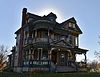 | July 14, 1983 (#83000348) | 222 McLane St. 41°01′49″N 93°46′08″W / 41.030319°N 93.768862°W / 41.030319; -93.768862 (J.V. Banta House) | Osceola | |
2 | Chicago, Burlington and Quincy Depot |  | January 8, 2009 (#08001283) | 215 N. Main St. 41°02′12″N 93°45′56″W / 41.03663°N 93.76566°W / 41.03663; -93.76566 (Chicago, Burlington and Quincy Depot) | Osceola | Part of the Advent & Development of Railroads in Iowa Multiple Property Submission |
3 | George H. and Alice Spaulding Cowles House |  | December 20, 2006 (#06001161) | 229 W. Cass St. 41°02′03″N 93°46′09″W / 41.034167°N 93.769167°W / 41.034167; -93.769167 (George H. and Alice Spaulding Cowles House) | Osceola | |
4 | John and Mary Jane Kyte Farmstead District |  | September 14, 2000 (#00001074) | 2875 Mormon Trail Rd. 40°56′09″N 93°39′22″W / 40.935833°N 93.656111°W / 40.935833; -93.656111 (John and Mary Jane Kyte Farmstead District) | Weldon | |
5 | Osceola Masonic Block |  | July 6, 2010 (#10000421) | 101-103 South Main St. 41°02′05″N 93°45′55″W / 41.034722°N 93.765278°W / 41.034722; -93.765278 (Osceola Masonic Block) | Osceola | |
6 | Marcellus Luther and Julia Protzman Temple House | 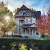 | April 4, 1996 (#96000361) | 502 S. Main St. 41°01′46″N 93°45′57″W / 41.029444°N 93.765833°W / 41.029444; -93.765833 (Marcellus Luther and Julia Protzman Temple House) | Osceola | |
7 | Osceola Commercial Historic District | January 19, 2018 (#100001971) | S Fillmore, N & S Main, E & W Jefferson & E & W Washington Sts. 41°02′04″N 93°45′59″W / 41.034346°N 93.766523°W / 41.034346; -93.766523 (Osceola Commercial Historic District) | Osceola | ||
8 | Dickinson Webster House |  | July 20, 1977 (#77000501) | 609 W. Jefferson St. 41°02′12″N 93°46′02″W / 41.036667°N 93.767222°W / 41.036667; -93.767222 (Dickinson Webster House) | Osceola |
Former listing[edit]
| [7] | Name on the Register | Image | Date listed | Date removed | Location | City or town | Summary |
|---|---|---|---|---|---|---|---|
1 | Brady-Bolibaugh House | January 3, 1985 (#85000003) | May 12, 2009 | 217 W. Washington 41°02′12″N 93°45′45″W / 41.036667°N 93.7625°W / 41.036667; -93.7625 (Brady-Bolibaugh House) | Osceola |
Clay County[edit]
Clayton County[edit]
Clinton County[edit]
Crawford County[edit]
Dallas County[edit]
Davis County[edit]
Decatur County[edit]
| [7] | Name on the Register | Image | Date listed[8] | Location | City or town | Description |
|---|---|---|---|---|---|---|
1 | Decatur County Courthouse | 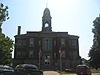 | July 2, 1981 (#81000233) | 9th St. 40°44′26″N 93°44′46″W / 40.740556°N 93.746111°W / 40.740556; -93.746111 (Decatur County Courthouse) | Leon | |
2 | Grand River Bridge | 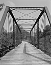 | June 25, 1998 (#98000794) | County road over the Grand River 40°43′18″N 93°52′33″W / 40.721667°N 93.875833°W / 40.721667; -93.875833 (Grand River Bridge) | Leon | |
3 | Liberty Hall |  | September 29, 1983 (#83000350) | Main St. 40°37′30″N 93°57′07″W / 40.625°N 93.951944°W / 40.625; -93.951944 (Liberty Hall) | Lamoni | |
4 | J.J. McClung House |  | December 6, 1990 (#90001856) | Junction of Main and Vine Sts. 40°49′38″N 93°36′36″W / 40.827222°N 93.61°W / 40.827222; -93.61 (J.J. McClung House) | Garden Grove | |
5 | Missouri, Iowa & Nebraska Railway Co. Depot-Weldon |  | December 13, 1991 (#91001827) | N. Main St. at the Decatur County line 40°53′57″N 93°44′01″W / 40.899167°N 93.733611°W / 40.899167; -93.733611 (Missouri, Iowa & Nebraska Railway Co. Depot-Weldon) | Weldon | |
6 | C.S. Stearns House | 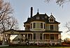 | November 28, 1978 (#78001214) | Main St. 40°49′36″N 93°36′10″W / 40.826667°N 93.602778°W / 40.826667; -93.602778 (C.S. Stearns House) | Garden Grove | |
7 | Union Church |  | December 12, 1976 (#76000759) | Clark at Sycamore St. 40°38′21″N 93°48′23″W / 40.639167°N 93.806389°W / 40.639167; -93.806389 (Union Church) | Davis City |
Delaware County[edit]
Des Moines County[edit]
Dickinson County[edit]
Dubuque County[edit]
Emmet County[edit]
| [7] | Name on the Register | Image | Date listed[8] | Location | City or town | Description |
|---|---|---|---|---|---|---|
1 | Brugjeld-Peterson Family Farmstead District |  | April 6, 2000 (#00000326) | 2349 450th Ave. 43°18′17″N 94°42′02″W / 43.304722°N 94.700556°W / 43.304722; -94.700556 (Brugjeld-Peterson Family Farmstead District) | Wallingford | |
2 | Ellsworth Ranch Bridge | 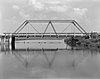 | July 15, 1998 (#98000869) | 130th St. over the East Fork of the Des Moines River 43°27′36″N 94°34′49″W / 43.46°N 94.580278°W / 43.46; -94.580278 (Ellsworth Ranch Bridge) | Armstrong | |
3 | Thomsen Round Barn | June 30, 1986 (#86001426) | Off Iowa Highway 15 43°20′46″N 94°29′52″W / 43.346111°N 94.497778°W / 43.346111; -94.497778 (Thomsen Round Barn) | Armstrong |
Fayette County[edit]
Floyd County[edit]
Franklin County[edit]
Fremont County[edit]
Greene County[edit]
Grundy County[edit]
| [7] | Name on the Register | Image | Date listed[8] | Location | City or town | Description |
|---|---|---|---|---|---|---|
1 | Grundy County Courthouse |  | July 2, 1981 (#81000239) | Grundy Ave. 42°21′31″N 92°46′18″W / 42.358611°N 92.771667°W / 42.358611; -92.771667 (Grundy County Courthouse) | Grundy Center | |
2 | Chris Neessen House | January 12, 1984 (#84001253) | 601 E. 4th 42°26′04″N 92°55′29″W / 42.434444°N 92.924722°W / 42.434444; -92.924722 (Chris Neessen House) | Wellsburg |
Guthrie County[edit]
| [7] | Name on the Register | Image | Date listed[8] | Location | City or town | Description |
|---|---|---|---|---|---|---|
1 | All Saints Catholic Church | 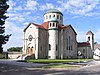 | December 7, 2000 (#00001478) | 420 N. Fremont 41°30′25″N 94°19′02″W / 41.506944°N 94.317222°W / 41.506944; -94.317222 (All Saints Catholic Church) | Stuart | |
2 | John Cretsinger House | October 7, 1998 (#98001206) | 1363 Burl Ln. 41°48′46″N 94°42′52″W / 41.812778°N 94.714444°W / 41.812778; -94.714444 (John Cretsinger House) | Coon Rapids | ||
3 | Roswell and Elizabeth Garst Farmstead Historic District | August 12, 2009 (#09000610) | 1390 Iowa Highway 141 41°50′55″N 94°38′43″W / 41.848544°N 94.64515°W / 41.848544; -94.64515 (Roswell and Elizabeth Garst Farmstead Historic District) | Coon Rapids | ||
4 | Masonic Temple Building | 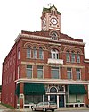 | April 12, 1996 (#96000400) | 1311 N. 2nd St. 41°30′18″N 94°19′07″W / 41.505°N 94.318611°W / 41.505; -94.318611 (Masonic Temple Building) | Stuart | |
5 | Octagon Barn, Richland Township | June 30, 1986 (#86001433) | Off Iowa Highway 141 41°49′24″N 94°20′10″W / 41.823333°N 94.336111°W / 41.823333; -94.336111 (Octagon Barn, Richland Township) | Richland Township | ||
6 | Sexton Hotel | 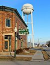 | December 18, 2013 (#13000924) | 203 E. Front Street 41°30′14″N 94°19′00″W / 41.503832°N 94.316748°W / 41.503832; -94.316748 (Sexton Hotel) | Stuart | |
7 | Springbrook State Park, Civilian Conservation Corps Area |  | November 15, 1990 (#90001671) | Junction of Iowa Highway 384 and County Highway F25 41°46′38″N 94°27′54″W / 41.777222°N 94.465°W / 41.777222; -94.465 (Springbrook State Park, Civilian Conservation Corps Area) | Guthrie Center | |
8 | Yale High School Gymnasium | December 28, 2018 (#100003261) | 414 Lincoln St. 41°46′28″N 94°21′26″W / 41.774408°N 94.357173°W / 41.774408; -94.357173 (Yale High School Gymnasium) | Yale |
Former listings[edit]
| [7] | Name on the Register | Image | Date listed | Date removed | Location | City or town | Summary |
|---|---|---|---|---|---|---|---|
1 | Panora-Linden High School | July 23, 1974 (#74000786) | May 22, 1998 | Bounded by Main, Market, 1st, and 2nd Sts. | Panora | Torn down in 1991[9] |
Hamilton County[edit]
| [7] | Name on the Register | Image | Date listed[8] | Location | City or town | Description |
|---|---|---|---|---|---|---|
1 | Albright Bridge | 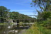 | June 25, 1998 (#98000776) | 130th St. at 510th Ave. over the Boone River 42°24′20″N 93°48′36″W / 42.405556°N 93.81°W / 42.405556; -93.81 (Albright Bridge) | Webster City | |
2 | Kendall Young Public Library |  | May 23, 1983 (#83000361) | 1201 Willson Ave. 42°27′30″N 93°50′12″W / 42.458333°N 93.836667°W / 42.458333; -93.836667 (Kendall Young Public Library) | Webster City | |
3 | William Oakland Round Barn |  | June 30, 1986 (#86001434) | Off U.S. Route 69 42°29′11″N 93°38′00″W / 42.486389°N 93.633333°W / 42.486389; -93.633333 (William Oakland Round Barn) | Blairsburg | |
4 | Schultz Brothers Drug Store |  | May 16, 1996 (#96000518) | 116 Main St. 42°29′19″N 93°32′38″W / 42.488611°N 93.543889°W / 42.488611; -93.543889 (Schultz Brothers Drug Store) | Williams | |
5 | State Bank of Stratford |  | July 7, 1983 (#83000362) | 801 Shakespeare St. 42°16′14″N 93°55′01″W / 42.270556°N 93.916944°W / 42.270556; -93.916944 (State Bank of Stratford) | Stratford | |
6 | Tremaine Bridge | 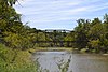 | May 15, 1998 (#98000519) | 280th St. over the Boone River 42°23′12″N 93°48′31″W / 42.386667°N 93.808611°W / 42.386667; -93.808611 (Tremaine Bridge) | Webster City | |
7 | Webster City Post Office | 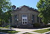 | July 6, 1982 (#82002619) | 801 Willson Ave. 42°28′06″N 93°49′09″W / 42.468333°N 93.819167°W / 42.468333; -93.819167 (Webster City Post Office) | Webster City | |
8 | William J. and Hattie J. Zitterell House |  | February 16, 1996 (#96000057) | 821 Division St. 42°28′04″N 93°49′28″W / 42.467778°N 93.824444°W / 42.467778; -93.824444 (William J. and Hattie J. Zitterell House) | Webster City |
Hancock County[edit]
Hardin County[edit]
Harrison County[edit]
Henry County[edit]
Howard County[edit]
| [7] | Name on the Register | Image | Date listed[8] | Location | City or town | Description |
|---|---|---|---|---|---|---|
1 | Bohemian Savings Bank | 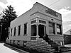 | September 13, 1990 (#88002806) | Main St. 43°13′05″N 92°05′26″W / 43.218056°N 92.090556°W / 43.218056; -92.090556 (Bohemian Savings Bank) | Protivin | |
2 | Cresco Opera House | 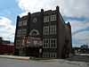 | August 27, 1981 (#81000245) | 115 W. 2nd Ave. 43°21′12″N 92°08′04″W / 43.353333°N 92.134444°W / 43.353333; -92.134444 (Cresco Opera House) | Cresco | |
3 | James C. Fellows House | 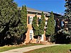 | June 21, 1982 (#82002621) | Main St. 43°22′02″N 92°33′05″W / 43.367222°N 92.551389°W / 43.367222; -92.551389 (James C. Fellows House) | Riceville | |
4 | Howard County Courthouse |  | July 2, 1981 (#81000246) | Elm St. 43°22′26″N 92°07′03″W / 43.373889°N 92.1175°W / 43.373889; -92.1175 (Howard County Courthouse) | Cresco | |
5 | Kellow House |  | November 22, 1977 (#77000517) | 324 4th Ave., W. 43°22′33″N 92°07′16″W / 43.375833°N 92.121111°W / 43.375833; -92.121111 (Kellow House) | Cresco | |
6 | Lime Springs Mill Complex |  | April 11, 1977 (#77000518) | Former Iowa Highway 157 43°27′54″N 92°16′45″W / 43.465°N 92.279167°W / 43.465; -92.279167 (Lime Springs Mill Complex) | Lime Springs | |
7 | Polygonal Barn, New Oregon Township | June 30, 1986 (#86001437) | Off Iowa Highway 39 43°13′32″N 92°07′38″W / 43.225556°N 92.127222°W / 43.225556; -92.127222 (Polygonal Barn, New Oregon Township) | New Oregon Township | ||
8 | South Ward School |  | November 10, 1982 (#82000408) | 500 S. Elm St. 43°22′03″N 92°07′02″W / 43.3675°N 92.117222°W / 43.3675; -92.117222 (South Ward School) | Cresco |
Humboldt County[edit]
| [7] | Name on the Register | Image | Date listed[8] | Location | City or town | Description |
|---|---|---|---|---|---|---|
1 | Berkhimer Bridge |  | May 15, 1998 (#98000523) | 245th St. over the Des Moines River 42°44′21″N 94°15′11″W / 42.739167°N 94.253056°W / 42.739167; -94.253056 (Berkhimer Bridge) | Humboldt | |
2 | Corydon Brown House |  | November 14, 1978 (#78001223) | East of Dakota City off Iowa Highway 3 42°43′28″N 94°11′27″W / 42.724444°N 94.190833°W / 42.724444; -94.190833 (Corydon Brown House) | Dakota City | |
3 | Des Moines River Bridge | May 15, 1998 (#98000522) | Iowa Highway 3 over the West Fork of the Des Moines River 42°43′55″N 94°15′30″W / 42.731944°N 94.258333°W / 42.731944; -94.258333 (Des Moines River Bridge) | Humboldt | Replaced in 2010 | |
4 | Humboldt County Court House |  | August 28, 2003 (#03000823) | 203 Main St. 42°43′21″N 94°12′58″W / 42.7225°N 94.216111°W / 42.7225; -94.216111 (Humboldt County Court House) | Dakota City | |
5 | Humboldt Free Public Library |  | May 23, 1983 (#83000368) | 30 6th St., N. 42°43′16″N 94°13′10″W / 42.721111°N 94.219444°W / 42.721111; -94.219444 (Humboldt Free Public Library) | Humboldt | |
6 | Renwick Generating Plant |  | February 17, 1995 (#95000099) | 103 N. Field St. 42°49′43″N 93°58′42″W / 42.828611°N 93.978333°W / 42.828611; -93.978333 (Renwick Generating Plant) | Renwick | |
7 | Stephen Harris Taft House | 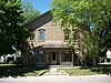 | December 27, 2002 (#02001601) | 809 1st Ave., N. 42°43′20″N 94°13′11″W / 42.722222°N 94.219722°W / 42.722222; -94.219722 (Stephen Harris Taft House) | Humboldt |
Ida County[edit]
| [7] | Name on the Register | Image | Date listed[8] | Location | City or town | Description |
|---|---|---|---|---|---|---|
1 | Alvin Bushnell Bell House |  | January 27, 1983 (#83000369) | 310 Quimby St. 42°20′37″N 95°28′27″W / 42.343611°N 95.474167°W / 42.343611; -95.474167 (Alvin Bushnell Bell House) | Ida Grove | Designed by architect George Franklin Barber |
2 | Ida County Courthouse | 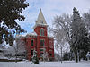 | March 15, 1974 (#74000787) | 401 Moorehead St. 42°20′31″N 95°28′04″W / 42.342023°N 95.467650°W / 42.342023; -95.467650 (Ida County Courthouse) | Ida Grove | |
3 | Moorehead Stagecoach Inn |  | August 27, 1974 (#74000788) | Off U.S. Route 59 42°21′15″N 95°28′44″W / 42.354167°N 95.478889°W / 42.354167; -95.478889 (Moorehead Stagecoach Inn) | Ida Grove | |
4 | Dr. Francis B. Warnock House | October 13, 1988 (#88001945) | 201 Maple St. 42°18′57″N 95°36′02″W / 42.315806°N 95.600637°W / 42.315806; -95.600637 (Dr. Francis B. Warnock House) | Battle Creek | Designed by architect George Franklin Barber | |
5 | Waveland Round Barn | June 30, 1986 (#86001438) | Off U.S. Route 20 42°29′46″N 95°42′09″W / 42.496111°N 95.7025°W / 42.496111; -95.7025 (Waveland Round Barn) | Cushing |
Former listings[edit]
| [7] | Name on the Register | Image | Date listed | Date removed | Location | City or town | Summary |
|---|---|---|---|---|---|---|---|
1 | Turner Hall | January 22, 1975 (#75000691) | June 21, 2007 | SE corner of Keil and 2nd Streets | Holstein |
Iowa County[edit]
Jackson County[edit]
Jasper County[edit]
Jefferson County[edit]
Johnson County[edit]
Jones County[edit]
Keokuk County[edit]
Kossuth County[edit]
| [7] | Name on the Register | Image | Date listed[8] | Location | City or town | Description |
|---|---|---|---|---|---|---|
1 | Algona Junior and Senior High School Building and High School Building Annex | December 10, 2014 (#14001006) | 213 and 301 S. Harlan St. 43°04′03″N 94°14′01″W / 43.067375°N 94.233652°W / 43.067375; -94.233652 (Algona Junior and Senior High School Building and High School Building Annex) | Algona | ||
2 | William C. and Hertha Dau House | July 29, 1993 (#93000654) | 315 S. Dodge St. 43°03′58″N 94°14′10″W / 43.066111°N 94.236111°W / 43.066111; -94.236111 (William C. and Hertha Dau House) | Algona | ||
3 | Des Moines River Bridge | May 15, 1998 (#98000535) | County Road P14 over the East Fork of the Des Moines River 43°20′42″N 94°26′33″W / 43.345°N 94.4425°W / 43.345; -94.4425 (Des Moines River Bridge) | Swea City | ||
4 | G.A.R. Memorial Hall | January 15, 2014 (#13001077) | 122 S. Dodge St. 43°04′07″N 94°14′12″W / 43.068636°N 94.236727°W / 43.068636; -94.236727 (G.A.R. Memorial Hall) | Algona | ||
5 | Land and Loan Office Building | 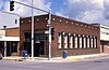 | March 19, 1998 (#98000250) | 123 E. State St. 43°04′08″N 94°14′08″W / 43.068889°N 94.235556°W / 43.068889; -94.235556 (Land and Loan Office Building) | Algona | Also known as the Henry Adams Building |
6 | Lu Verne City Jail | December 18, 1992 (#92001662) | 307 3rd St. 42°54′39″N 94°05′00″W / 42.910833°N 94.083333°W / 42.910833; -94.083333 (Lu Verne City Jail) | Lu Verne |
Former listings[edit]
| [7] | Name on the Register | Image | Date listed | Date removed | Location | City or town | Summary |
|---|---|---|---|---|---|---|---|
1 | Longbottom Polygonal Barn | June 30, 1986 (#86001456) | August 26, 2005 | Off Iowa Highway 226 | Titonka |
Lee County[edit]
Linn County[edit]
Louisa County[edit]
| [7] | Name on the Register | Image | Date listed[8] | Location | City or town | Description |
|---|---|---|---|---|---|---|
1 | Bethel Church |  | February 22, 1979 (#79003698) | Northeast of Morning Sun, off U.S. Route 61 41°06′37″N 91°11′14″W / 41.11035833°N 91.18711389°W / 41.11035833; -91.18711389 (Bethel Church) | Morning Sun | |
2 | Community Building |  | August 14, 1973 (#73000735) | 122 E. Maple St. 41°16′36″N 91°21′37″W / 41.276667°N 91.360278°W / 41.276667; -91.360278 (Community Building) | Columbus Junction | |
3 | Commercial Hotel | 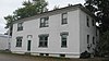 | August 30, 2001 (#01000912) | 227 N. Main St. 41°10′52″N 91°11′13″W / 41.181111°N 91.186944°W / 41.181111; -91.186944 (Commercial Hotel) | Wapello | |
4 | County Line Bridge |  | May 15, 1998 (#98000513) | 140th block of County Line Rd. over Long Creek 41°16′01″N 91°29′07″W / 41.266944°N 91.485139°W / 41.266944; -91.485139 (County Line Bridge) | Columbus Junction | Extends into Washington County |
5 | Florence-Council On The Iowa Site |  | December 27, 1978 (#78001243) | At the site of the now-gone village of Florence[10] 41°06′29″N 91°06′57″W / 41.108056°N 91.115833°W / 41.108056; -91.115833 (Florence-Council On The Iowa Site) | Oakville | |
6 | Gipple's Quarry Bridge |  | May 15, 1998 (#98000512) | 100 block of V Ave. over Buffington Creek 41°12′17″N 91°24′31″W / 41.204722°N 91.408611°W / 41.204722; -91.408611 (Gipple's Quarry Bridge) | Columbus Junction | |
7 | Louisa County Courthouse |  | July 2, 1981 (#81000253) | Main St. 41°10′43″N 91°11′10″W / 41.178611°N 91.186111°W / 41.178611; -91.186111 (Louisa County Courthouse) | Wapello | |
8 | Toolesboro Mound Group | October 15, 1966 (#66000337) | 6568 Toolesboro Rd.[11] 41°08′34″N 91°03′50″W / 41.142778°N 91.063889°W / 41.142778; -91.063889 (Toolesboro Mound Group) | Toolesboro |
Former listing[edit]
| [7] | Name on the Register | Image | Date listed | Date removed | Location | City or town | Summary |
|---|---|---|---|---|---|---|---|
1 | Judge Francis Springer House | January 27, 1983 (#83000388) | September 5, 2000 | South of Columbus City | Columbus City | Burned by owner in October 1997.[12] |
Lucas County[edit]
Lyon County[edit]
Madison County[edit]
Mahaska County[edit]
Marion County[edit]
Marshall County[edit]
Mills County[edit]
| [7] | Name on the Register | Image | Date listed[8] | Location | City or town | Description |
|---|---|---|---|---|---|---|
1 | Davis Oriole Earthlodge Site |  | October 16, 2012 (#12001018) | in Pony Creek Park 41°04′15″N 95°47′17″W / 41.070780°N 95.787957°W / 41.070780; -95.787957 (Davis Oriole Earthlodge Site) | Glenwood vicinity | |
2 | Glenwood Archeological District | 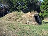 | May 22, 2013 (#13000296) | Address Restricted | Glenwood | part of the Archeological Resources of the Central Plains Tradition in the Loess Hills Region of Iowa MPS |
3 | Nishnabotna River Bridge | May 15, 1998 (#98000496) | County Road M16 over the Nishnabotna River north of Henderson 41°05′21″N 95°28′49″W / 41.089167°N 95.480278°W / 41.089167; -95.480278 (Nishnabotna River Bridge) | Anderson Township | ||
4 | Plattsmouth Bridge |  | April 15, 1993 (#92000755) | U.S. Route 34 over the Missouri River southwest of Pacific Junction 41°00′03″N 95°52′01″W / 41.00096°N 95.866836°W / 41.00096; -95.866836 (Plattsmouth Bridge) | Plattville Township | Extends into Cass County, Nebraska |
5 | Pony Creek Park | | July 30, 1971 (#71000299) | Northwest of Glenwood 41°04′16″N 95°47′12″W / 41.071111°N 95.786667°W / 41.071111; -95.786667 (Pony Creek Park) | Oak Township | |
6 | West Oak Forest Earthlodge Site | 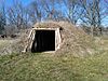 | June 11, 2010 (#10000342) | Address Restricted | Glenwood | part of the Archeological Resources of the Central Plains Tradition in the Loess Hills Region of Iowa MPS |
Mitchell County[edit]
Monona County[edit]
Monroe County[edit]
Montgomery County[edit]
Muscatine County[edit]
O'Brien County[edit]
| [7] | Name on the Register | Image | Date listed[8] | Location | City or town | Description |
|---|---|---|---|---|---|---|
1 | Carnegie Library | 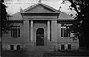 | April 11, 1977 (#77001504) | 321 10th St. 43°10′47″N 95°51′14″W / 43.179722°N 95.853889°W / 43.179722; -95.853889 (Carnegie Library) | Sheldon | |
2 | Indian Village Site |  | October 15, 1966 (#66000888) | Left bank of Waterman Creek, east of Sutherland[13] 42°58′50″N 95°25′22″W / 42.980556°N 95.422778°W / 42.980556; -95.422778 (Indian Village Site) | Sutherland | |
3 | O'Brien County Courthouse |  | July 2, 1981 (#81000656) | Fir Ave. 43°05′12″N 95°37′38″W / 43.086667°N 95.627222°W / 43.086667; -95.627222 (O'Brien County Courthouse) | Primghar |
Osceola County[edit]
| [7] | Name on the Register | Image | Date listed[8] | Location | City or town | Description |
|---|---|---|---|---|---|---|
1 | Osceola County Courthouse |  | July 2, 1981 (#81000261) | 3rd Ave. and 8th St. 43°24′07″N 95°44′51″W / 43.401944°N 95.7475°W / 43.401944; -95.7475 (Osceola County Courthouse) | Sibley |
Page County[edit]
Palo Alto County[edit]
| [7] | Name on the Register | Image | Date listed[8] | Location | City or town | Description |
|---|---|---|---|---|---|---|
1 | Emmetsburg Public Library | 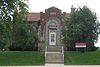 | May 23, 1983 (#83000397) | 10th St. on Courthouse Sq. 43°05′19″N 94°41′52″W / 43.088611°N 94.697778°W / 43.088611; -94.697778 (Emmetsburg Public Library) | Emmetsburg | |
2 | First Presbyterian Church | May 24, 2010 (#10000276) | 101 1st Ave. SW 42°57′35″N 94°26′47″W / 42.959683°N 94.446417°W / 42.959683; -94.446417 (First Presbyterian Church) | West Bend | ||
3 | Grotto of the Redemption | 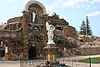 | February 23, 2001 (#00001679) | 300 N. Broadway 42°57′50″N 94°26′44″W / 42.963889°N 94.445556°W / 42.963889; -94.445556 (Grotto of the Redemption) | West Bend | |
4 | Ormsby-Kelly House | July 29, 1977 (#77000545) | 2403 W. 7th St. 43°06′46″N 94°41′02″W / 43.112778°N 94.683889°W / 43.112778; -94.683889 (Ormsby-Kelly House) | Emmetsburg |
Plymouth County[edit]
Pocahontas County[edit]
| [7] | Name on the Register | Image | Date listed[8] | Location | City or town | Description |
|---|---|---|---|---|---|---|
1 | Laurens Carnegie Free Library |  | November 5, 1974 (#74000804) | 263 N. 3rd St. 42°50′54″N 94°50′56″W / 42.848333°N 94.848889°W / 42.848333; -94.848889 (Laurens Carnegie Free Library) | Laurens | |
2 | Pocahontas County Courthouse |  | July 2, 1981 (#81000264) | Court Sq. 42°44′14″N 94°40′07″W / 42.737222°N 94.668611°W / 42.737222; -94.668611 (Pocahontas County Courthouse) | Pocahontas | |
3 | Saints Peter and Paul Catholic Church |  | March 1, 1994 (#94000086) | 16 2nd Ave., NW. 42°44′05″N 94°40′15″W / 42.734722°N 94.670833°W / 42.734722; -94.670833 (Saints Peter and Paul Catholic Church) | Pocahontas |
Polk County[edit]
Pottawattamie County[edit]
Poweshiek County[edit]
Ringgold County[edit]
| [7] | Name on the Register | Image | Date listed[8] | Location | City or town | Description |
|---|---|---|---|---|---|---|
1 | Beaconsfield Supply Store | May 24, 2007 (#07000451) | 1621 Main St. 40°48′27″N 94°03′01″W / 40.8076°N 94.0504°W / 40.8076; -94.0504 (Beaconsfield Supply Store) | Beaconsfield | 1916 one-story brick building which was the birthplace of the Hy-Vee chain of stores and later served as a telephone office, city hall, and community center. | |
2 | W.J. Buck Polygonal Barn | June 30, 1986 (#86001471) | Off U.S. Route 169 40°46′57″N 94°15′25″W / 40.7825°N 94.256944°W / 40.7825; -94.256944 (W.J. Buck Polygonal Barn) | Diagonal | ||
3 | Middlefork Methodist Episcopal Church | 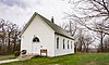 | November 29, 1990 (#90001801) | South of U.S. Route 169 on the eastern side of the Middle Fork Grand River 40°35′47″N 94°19′03″W / 40.596389°N 94.3175°W / 40.596389; -94.3175 (Middlefork Methodist Episcopal Church) | Redding | |
4 | Ringgold County Courthouse |  | July 2, 1981 (#81000267) | Madison St. 40°42′46″N 94°14′26″W / 40.712778°N 94.240556°W / 40.712778; -94.240556 (Ringgold County Courthouse) | Mount Ayr | |
5 | Ringgold County Jail | 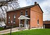 | June 19, 1979 (#79000939) | 201 E. Monroe St. 40°42′43″N 94°14′09″W / 40.711944°N 94.235833°W / 40.711944; -94.235833 (Ringgold County Jail) | Mount Ayr | |
6 | Lee Shay Farmhouse |  | November 6, 1986 (#86003172) | Off County Road P27 40°41′13″N 94°22′57″W / 40.686944°N 94.3825°W / 40.686944; -94.3825 (Lee Shay Farmhouse) | Maloy |
Sac County[edit]
Scott County[edit]
Shelby County[edit]
Sioux County[edit]
| [7] | Name on the Register | Image | Date listed[8] | Location | City or town | Description |
|---|---|---|---|---|---|---|
1 | Charles M. and Emma M. Fischer Fleshman House |  | January 7, 1993 (#92001743) | 919 9th St. 42°59′44″N 96°28′52″W / 42.995556°N 96.481111°W / 42.995556; -96.481111 (Charles M. and Emma M. Fischer Fleshman House) | Hawarden | |
2 | Hawarden City Hall, Fire Station and Auditorium |  | March 10, 2009 (#09000107) | 715 Central Ave. 42°59′39″N 96°29′08″W / 42.994167°N 96.485556°W / 42.994167; -96.485556 (Hawarden City Hall, Fire Station and Auditorium) | Hawarden | |
3 | Sioux County Courthouse | 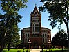 | April 11, 1977 (#77000559) | Off Iowa Highway 10 43°00′16″N 96°03′32″W / 43.004557°N 96.058889°W / 43.004557; -96.058889 (Sioux County Courthouse) | Orange City | |
4 | Zwemer Hall, Northwestern College |  | May 28, 1975 (#75000698) | 101 7th St., SW. 42°59′53″N 96°03′30″W / 42.997963°N 96.058306°W / 42.997963; -96.058306 (Zwemer Hall, Northwestern College) | Orange City |
Story County[edit]
Tama County[edit]
Taylor County[edit]
| [7] | Name on the Register | Image | Date listed[8] | Location | City or town | Description |
|---|---|---|---|---|---|---|
1 | Bedford Commercial Historic District |  | September 12, 2002 (#02001032) | 200-500 blocks of Main St., the 500 and 600 blocks of Court, and the 500 block of Central 40°40′01″N 94°43′07″W / 40.666944°N 94.718611°W / 40.666944; -94.718611 (Bedford Commercial Historic District) | Bedford | |
2 | Bedford House |  | June 14, 1977 (#77000560) | 306 Main St. 40°40′04″N 94°43′13″W / 40.667778°N 94.720278°W / 40.667778; -94.720278 (Bedford House) | Bedford | |
3 | Bedford Oil Company Station | July 15, 1999 (#99000831) | 601 Madison 40°40′02″N 94°43′15″W / 40.667222°N 94.720833°W / 40.667222; -94.720833 (Bedford Oil Company Station) | Bedford | ||
4 | Bedford Public Library |  | May 23, 1983 (#83000405) | Jefferson St. 40°36′29″N 94°44′53″W / 40.608056°N 94.748056°W / 40.608056; -94.748056 (Bedford Public Library) | Bedford | |
5 | Lenox Hotel |  | December 20, 2002 (#02001538) | 114 S. Main St. 40°52′52″N 94°33′33″W / 40.881111°N 94.559167°W / 40.881111; -94.559167 (Lenox Hotel) | Lenox | |
6 | Lenox Round Barn |  | May 5, 1999 (#99000490) | 1001 Pollock Boulevard 40°40′39″N 94°43′45″W / 40.6775°N 94.729167°W / 40.6775; -94.729167 (Lenox Round Barn) | Bedford | |
7 | Taylor County Courthouse |  | July 2, 1981 (#81000271) | Court Ave. 40°40′01″N 94°43′08″W / 40.666944°N 94.718889°W / 40.666944; -94.718889 (Taylor County Courthouse) | Bedford |
Union County[edit]
| [7] | Name on the Register | Image | Date listed[8] | Location | City or town | Description |
|---|---|---|---|---|---|---|
1 | Chicago, Burlington and Quincy Railroad-Creston Station | 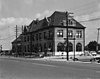 | August 15, 1973 (#73000739) | 200 W. Adams St. 41°03′25″N 94°21′45″W / 41.056944°N 94.3625°W / 41.056944; -94.3625 (Chicago, Burlington and Quincy Railroad-Creston Station) | Creston | |
2 | Grand River Bridge | May 15, 1998 (#98000479) | 230th St. over the Grand River 40°57′48″N 94°02′20″W / 40.963333°N 94.038889°W / 40.963333; -94.038889 (Grand River Bridge) | Arispe | ||
3 | Iowana Hotel |  | May 12, 2009 (#09000298) | 203 W. Montgomery St. 41°03′31″N 94°21′47″W / 41.058611°N 94.363056°W / 41.058611; -94.363056 (Iowana Hotel) | Creston | |
4 | Jefferson Elementary School |  | October 24, 2002 (#02001223) | 501 North Cherry 41°03′45″N 94°21′23″W / 41.0625°N 94.356389°W / 41.0625; -94.356389 (Jefferson Elementary School) | Creston | |
5 | Odd Fellows Block | January 15, 2014 (#13001079) | 175 E. Kansas St. 41°01′42″N 94°11′49″W / 41.028224°N 94.196845°W / 41.028224; -94.196845 (Odd Fellows Block) | Afton | ||
6 | U.S. Post Office |  | December 8, 1978 (#78001264) | Maple St. 41°03′34″N 94°21′46″W / 41.059444°N 94.362778°W / 41.059444; -94.362778 (U.S. Post Office) | Creston |
Van Buren County[edit]
Wapello County[edit]
Warren County[edit]
Washington County[edit]
Wayne County[edit]
| [7] | Name on the Register | Image | Date listed[8] | Location | City or town | Description |
|---|---|---|---|---|---|---|
1 | Nelson Round Barn | November 19, 1986 (#86003189) | County Road J46 40°42′24″N 93°20′44″W / 40.706667°N 93.345556°W / 40.706667; -93.345556 (Nelson Round Barn) | Allerton | ||
2 | Pleasant Hill School | May 28, 1975 (#75000701) | 3 miles north of Lineville on U.S. Route 65 40°37′26″N 93°29′48″W / 40.623889°N 93.496667°W / 40.623889; -93.496667 (Pleasant Hill School) | Lineville | ||
3 | W.H. Tedford House | March 26, 1979 (#79000947) | 312 S. West St. 40°45′25″N 93°19′24″W / 40.756944°N 93.323333°W / 40.756944; -93.323333 (W.H. Tedford House) | Corydon |
Webster County[edit]
Winnebago County[edit]
| [7] | Name on the Register | Image | Date listed[8] | Location | City or town | Description |
|---|---|---|---|---|---|---|
1 | Round Barn, Norway Township | February 27, 1987 (#87000507) | Off County Road R60 43°29′22″N 93°35′51″W / 43.489444°N 93.5975°W / 43.489444; -93.5975 (Round Barn, Norway Township) | Norway Township | ||
2 | Charles J. Thompson House | 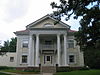 | November 30, 1978 (#78001271) | 336 N. Clark St. 43°15′58″N 93°38′18″W / 43.266111°N 93.638333°W / 43.266111; -93.638333 (Charles J. Thompson House) | Forest City | |
3 | Winnebago County Courthouse |  | July 2, 1981 (#81000275) | J St. 43°15′47″N 93°38′19″W / 43.263056°N 93.638611°W / 43.263056; -93.638611 (Winnebago County Courthouse) | Forest City |
Former listings[edit]
| [7] | Name on the Register | Image | Date listed | Date removed | Location | City or town | Summary |
|---|---|---|---|---|---|---|---|
1 | Forest City Public Library | April 5, 1984 (#84001609) | March 7, 2016 | E. I St. and Clark 43°15′56″N 93°38′15″W / 43.265556°N 93.6375°W / 43.265556; -93.6375 (Forest City Public Library) | Forest City |
Winneshiek County[edit]
Woodbury County[edit]
Worth County[edit]
| [7] | Name on the Register | Image | Date listed[8] | Location | City or town | Description |
|---|---|---|---|---|---|---|
1 | Chicago, Milwaukee, and St. Paul Railroad-Grafton Station | June 23, 1976 (#76000815) | Iowa Highway 337 43°19′33″N 93°04′13″W / 43.325833°N 93.070278°W / 43.325833; -93.070278 (Chicago, Milwaukee, and St. Paul Railroad-Grafton Station) | Grafton | ||
2 | First Methodist Episcopal Church |  | August 16, 2000 (#00000985) | 401 Second Street 43°21′07″N 93°12′40″W / 43.351944°N 93.211111°W / 43.351944; -93.211111 (First Methodist Episcopal Church) | Kensett | |
3 | Northwood Central Avenue Historic District |  | September 19, 2006 (#06000857) | Roughly Central Avenue, W. near 5th St. to 9th St. on the east 43°26′46″N 93°13′22″W / 43.446111°N 93.222778°W / 43.446111; -93.222778 (Northwood Central Avenue Historic District) | Northwood | |
4 | Old Worth County Courthouse | 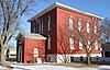 | July 2, 1981 (#81000276) | 921 Central Avenue 43°26′38″N 93°13′07″W / 43.443889°N 93.218611°W / 43.443889; -93.218611 (Old Worth County Courthouse) | Northwood | |
5 | Rhodes Mill |  | November 24, 1978 (#78001274) | Main Street 43°15′50″N 93°25′16″W / 43.263889°N 93.421111°W / 43.263889; -93.421111 (Rhodes Mill) | Fertile | |
6 | Worth County Courthouse |  | July 2, 1981 (#81000705) | Central Avenue between 10th and 11th Streets 43°26′40″N 93°13′03″W / 43.444444°N 93.2175°W / 43.444444; -93.2175 (Worth County Courthouse) | Northwood |
Wright County[edit]
See also[edit]
| Wikimedia Commons has media related to National Register of Historic Places in Iowa. |
- List of National Historic Landmarks in Iowa
References[edit]
^ "National Register of Historic Places: Weekly List Actions". National Park Service, United States Department of the Interior. Retrieved on April 12, 2019.
^ National Park Service (2008-04-24). "National Register Information System". National Register of Historic Places. National Park Service..mw-parser-output cite.citation{font-style:inherit}.mw-parser-output .citation q{quotes:"""""""'""'"}.mw-parser-output .citation .cs1-lock-free a{background:url("//upload.wikimedia.org/wikipedia/commons/thumb/6/65/Lock-green.svg/9px-Lock-green.svg.png")no-repeat;background-position:right .1em center}.mw-parser-output .citation .cs1-lock-limited a,.mw-parser-output .citation .cs1-lock-registration a{background:url("//upload.wikimedia.org/wikipedia/commons/thumb/d/d6/Lock-gray-alt-2.svg/9px-Lock-gray-alt-2.svg.png")no-repeat;background-position:right .1em center}.mw-parser-output .citation .cs1-lock-subscription a{background:url("//upload.wikimedia.org/wikipedia/commons/thumb/a/aa/Lock-red-alt-2.svg/9px-Lock-red-alt-2.svg.png")no-repeat;background-position:right .1em center}.mw-parser-output .cs1-subscription,.mw-parser-output .cs1-registration{color:#555}.mw-parser-output .cs1-subscription span,.mw-parser-output .cs1-registration span{border-bottom:1px dotted;cursor:help}.mw-parser-output .cs1-ws-icon a{background:url("//upload.wikimedia.org/wikipedia/commons/thumb/4/4c/Wikisource-logo.svg/12px-Wikisource-logo.svg.png")no-repeat;background-position:right .1em center}.mw-parser-output code.cs1-code{color:inherit;background:inherit;border:inherit;padding:inherit}.mw-parser-output .cs1-hidden-error{display:none;font-size:100%}.mw-parser-output .cs1-visible-error{font-size:100%}.mw-parser-output .cs1-maint{display:none;color:#33aa33;margin-left:0.3em}.mw-parser-output .cs1-subscription,.mw-parser-output .cs1-registration,.mw-parser-output .cs1-format{font-size:95%}.mw-parser-output .cs1-kern-left,.mw-parser-output .cs1-kern-wl-left{padding-left:0.2em}.mw-parser-output .cs1-kern-right,.mw-parser-output .cs1-kern-wl-right{padding-right:0.2em}
^ "National Register of Historic Places: Weekly List Actions". National Park Service. Retrieved January 2, 2009.
^ Weekly List Actions, National Register of Historic Places website
^ The Vander Veer Park Historic District is split between east and west Davenport.
^ Effigy Mounds National Monument is split between Allamakee and Clayton counties; Le Grand Bridge (1896) is split between Marshall and Tama counties; County Line Bridge is split between Louisa and Washington counties; Bridgeport Bridge is split between Des Moines and Lee counties
^ abcdefghijklmnopqrstuvwxyzaaabacadaeaf Numbers represent an ordering by significant words. Various colorings, defined here, differentiate National Historic Landmarks and historic districts from other NRHP buildings, structures, sites or objects.
^ abcdefghijklmnopqrstuvwxyz The eight-digit number below each date is the number assigned to each location in the National Register Information System database, which can be viewed by clicking the number.
^ [1]
^ Springer, Arthur. History of Louisa County Iowa From Its Earliest Settlement to 1912. Vol. 1. Chicago: Clarke, 1912, 13.
^ Address derived from this Louisa County Conservation Board page; the NRIS lists the site as "Address Restricted".
^ [2]
^ Vis, Robert B., and Dale R. Henning. "A Local Sequence for Mill Creek Sites in the Little Sioux River Valley". Plains Anthropologist 14.46 (1969): 253-271: 254.
Properties on the National Register of Historic Places in Iowa | |||
|---|---|---|---|
 |
|  | |
U.S. National Register of Historic Places | |
|---|---|
| Topics |
|
| Lists by state |
|
| Lists by insular areas |
|
| Lists by associated state |
|
| Other areas |
|
| |
Des Moines (capital) | ||
| Topics |
|  |
| Regions |
| |
| Largest cities |
| |
| Counties |
| |
Categories:
- National Register of Historic Places in Iowa
- Lists of National Register of Historic Places by state
- Iowa-related lists
(window.RLQ=window.RLQ||).push(function(){mw.config.set({"wgPageParseReport":{"limitreport":{"cputime":"2.612","walltime":"2.987","ppvisitednodes":{"value":64101,"limit":1000000},"ppgeneratednodes":{"value":0,"limit":1500000},"postexpandincludesize":{"value":932823,"limit":2097152},"templateargumentsize":{"value":76610,"limit":2097152},"expansiondepth":{"value":13,"limit":40},"expensivefunctioncount":{"value":0,"limit":500},"unstrip-depth":{"value":1,"limit":20},"unstrip-size":{"value":42792,"limit":5000000},"entityaccesscount":{"value":1,"limit":400},"timingprofile":["100.00% 1736.587 1 -total"," 64.24% 1115.570 144 Template:NRHP_row"," 17.09% 296.790 316 Template:First_word"," 14.32% 248.688 171 Template:Designation/color"," 14.06% 244.191 358 Template:NRHP_color"," 12.52% 217.392 138 Template:Coord"," 10.87% 188.847 150 Template:Dts"," 8.90% 154.487 138 Template:NRHP_Focus"," 8.58% 148.913 1 Template:Reflist"," 6.23% 108.120 2 Template:Cite_web"]},"scribunto":{"limitreport-timeusage":{"value":"0.737","limit":"10.000"},"limitreport-memusage":{"value":3538613,"limit":52428800}},"cachereport":{"origin":"mw1272","timestamp":"20190420141555","ttl":2592000,"transientcontent":false}}});});{"@context":"https://schema.org","@type":"Article","name":"National Register of Historic Places listings in Iowa","url":"https://en.wikipedia.org/wiki/National_Register_of_Historic_Places_listings_in_Iowa","sameAs":"http://www.wikidata.org/entity/Q1967630","mainEntity":"http://www.wikidata.org/entity/Q1967630","author":{"@type":"Organization","name":"Contributors to Wikimedia projects"},"publisher":{"@type":"Organization","name":"Wikimedia Foundation, Inc.","logo":{"@type":"ImageObject","url":"https://www.wikimedia.org/static/images/wmf-hor-googpub.png"}},"datePublished":"2005-12-27T19:18:57Z","dateModified":"2019-04-05T01:17:29Z","image":"https://upload.wikimedia.org/wikipedia/commons/3/3f/Iowa_counties_map.png","headline":"Wikimedia list article"}(window.RLQ=window.RLQ||).push(function(){mw.config.set({"wgBackendResponseTime":3176,"wgHostname":"mw1272"});});


