National Register of Historic Places listings in Multnomah County, Oregon
National Register of Historic Places listings in Multnomah County, Oregon
Jump to navigation
Jump to search

Location of Multnomah County in Oregon
The following list presents the full set of National Register of Historic Places listings in Multnomah County, Oregon. However, please see separate articles (links below) for listings in each of Portland's five quadrants.
The National Register of Historic Places recognizes buildings, structures, objects, sites, and districts of national, state, or local historic significance across the United States.[1] Out of over 90,000 National Register sites nationwide,[2]Oregon is home to over 2,000,[3] and over one-fourth of those are found in Multnomah County. In turn, the large majority (over 90%) of the county's National Register entries are situated within Portland.
This list includes only sites within Multnomah County but outside the municipal boundaries of Portland. While some sites appear in this list (and corresponding lists for neighboring counties) showing "Portland" as a general locality, based on their mailing addresses, they are nevertheless beyond city limits.
This National Park Service list is complete through NPS recent listings posted February 15, 2019.[4]
Contents
1 Current listings
1.1 Portland
1.2 Outside Portland
2 Former listings
3 See also
4 Notes
5 References
6 External links
Current listings[edit]
Portland[edit]
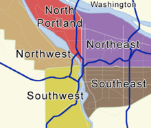
Locator map showing Portland's five quadrants. Click a quadrant to go to its National Register list.
Over 500 National Register listings lie within the municipal boundaries of Portland. Although all of these sites lie within Multnomah County, their sheer number makes it prohibitive to include them all in the same table. To find detailed listings for each of Portland's five quadrants, click on a link below or on the map at the right.
Lists by quadrant: North • Northeast • Northwest • Southeast • Southwest
Outside Portland[edit]
| [5] | Name on the Register | Image | Date listed[6] | Location | City or town | Description |
|---|---|---|---|---|---|---|
1 | Emanuel and Christina Anderson House |  | May 22, 2005 (#05000448) | 1420 SE Roberts Avenue 45°29′11″N 122°25′01″W / 45.486338°N 122.416815°W / 45.486338; -122.416815 (Emanuel and Christina Anderson House) | Gresham | |
2 | Rae Selling Berry Garden and House | December 31, 2002 (#02001637) | 11505 SW Summerville Avenue 45°26′33″N 122°39′43″W / 45.442380°N 122.661900°W / 45.442380; -122.661900 (Rae Selling Berry Garden and House) | Portland | ||
3 | Bonneville Dam Historic District |  | April 9, 1986 (#86000727) | Between Interstate 84 and Washington State Route 14 45°38′29″N 121°56′41″W / 45.641380°N 121.944600°W / 45.641380; -121.944600 (Bonneville Dam Historic District) | Bonneville (and North Bonneville, Washington) | Built in the 1930s to harness the Columbia River for power generation, this was the first hydroelectric dam with a hydraulic drop sufficient to produce 500,000 kW of hydropower. The NHL district covers the dam and other elements of the federal dam project, including the #1 powerhouse, navigation lock, fish ladder, and hatchery.[7] |
4 | Bybee–Howell House |  | November 5, 1974 (#74001716) | 13901 NW Howell Park Road 45°38′29″N 122°49′08″W / 45.641375°N 122.818872°W / 45.641375; -122.818872 (Bybee–Howell House) | Sauvie Island | |
5 | Columbia River Highway Historic District |  | December 12, 1983 (#83004168) | Roughly along the south side of the Columbia River[a] 45°32′23″N 122°14′39″W / 45.539747°N 122.244119°W / 45.539747; -122.244119 (Columbia River Highway Historic District) | Troutdale to The Dalles | Constructed between 1913 and 1922, this was the first scenic highway in the United States. Designed specifically to provide visitors access to the most outstanding of the scenic features of the Columbia River Gorge, the highway is also an outstanding example of modern highway development for its pioneering advances in road engineering.[8][9] |
6 | Elliott R. Corbett House |  | October 3, 1996 (#96001070) | 01600 SW Greenwood Road 45°26′01″N 122°39′43″W / 45.433669°N 122.662073°W / 45.433669; -122.662073 (Elliott R. Corbett House) | Portland vicinity | This 1915 Colonial Revival house is one of the finest examples of the residential work of Whitehouse and Fouilhoux, one of Portland's leading architecture firms in the second decade of the 20th century. It also represents the origins of the Dunthorpe neighborhood as a country-style suburb for Portland's elite.[10] |
7 | H. L. and Gretchen Hoyt Corbett House |  | February 28, 1991 (#91000129) | 01405 SW Corbett Hill Circle 45°26′19″N 122°39′50″W / 45.438562°N 122.663987°W / 45.438562; -122.663987 (H. L. and Gretchen Hoyt Corbett House) | Portland | |
8 | Maurice Crumpacker House |  | October 23, 1992 (#92001378) | 12714 SW Iron Mountain Boulevard 45°25′59″N 122°39′30″W / 45.433017°N 122.658370°W / 45.433017; -122.658370 (Maurice Crumpacker House) | Portland vicinity | |
9 | Fairview City Jail |  | May 23, 2016 (#16000290) | 120 1st Street 45°32′22″N 122°26′01″W / 45.539395°N 122.433726°W / 45.539395; -122.433726 (Fairview City Jail) | Fairview | |
10 | Roy and Leola Gangware House |  | February 23, 1990 (#90000284) | 4848 SW Humphrey Boulevard 45°30′17″N 122°43′35″W / 45.504596°N 122.726419°W / 45.504596; -122.726419 (Roy and Leola Gangware House) | Portland | |
11 | William Gedamke House |  | November 13, 1989 (#89001970) | 1304 E Powell Boulevard 45°29′52″N 122°25′06″W / 45.497678°N 122.418444°W / 45.497678; -122.418444 (William Gedamke House) | Gresham | Prominently located near Gresham's original business core, this house is one of the finest expressions of the Queen Anne style in the city. It was constructed ca. 1900, about the time the first interurban trains reached Gresham from Portland. The design was based on a widely-circulated 1891 mail-order plan book by George F. Barber.[11] |
12 | Andreas Graf House |  | November 13, 1980 (#80003356) | 44222 SE Loudon Road 45°30′40″N 122°12′29″W / 45.511019°N 122.208151°W / 45.511019; -122.208151 (Andreas Graf House) | Corbett | This house, originally built in the Carpenter Gothic style around 1885, was expanded and transformed into the more fashionable Queen Anne style around 1891. German immigrant Andreas Graf first staked his homestead claim in 1883, building the house using lumber he milled himself. Graf's descendants continued to own the house at least until 2014.[12][13] |
13 | Gresham Carnegie Library |  | January 24, 2000 (#99001715) | 410 N Main Street 45°30′02″N 122°25′51″W / 45.500532°N 122.430715°W / 45.500532; -122.430715 (Gresham Carnegie Library) | Gresham | |
14 | Charles Hunter Hamlin House |  | June 7, 2016 (#16000346) | 1322 SE 282nd Avenue 45°29′13″N 122°22′20″W / 45.486909°N 122.372295°W / 45.486909; -122.372295 (Charles Hunter Hamlin House) | Gresham | |
15 | Fred Harlow House |  | February 16, 1984 (#84003078) | 726 E Historic Columbia River Highway 45°32′17″N 122°22′57″W / 45.538150°N 122.382532°W / 45.538150; -122.382532 (Fred Harlow House) | Troutdale | |
16 | Pierre Rossiter and Charlotte Hines House |  | June 20, 2002 (#02000660) | 02393 SW Military Road 45°26′34″N 122°39′17″W / 45.442694°N 122.654858°W / 45.442694; -122.654858 (Pierre Rossiter and Charlotte Hines House) | Portland | |
17 | Dr. Herbert H. Hughes House |  | September 5, 2001 (#01000932) | 1229 W Powell Boulevard 45°29′51″N 122°26′40″W / 45.497403°N 122.444565°W / 45.497403; -122.444565 (Dr. Herbert H. Hughes House) | Gresham | |
18 | Joseph Jacobberger Country House | 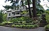 | January 24, 2011 (#10001171) | 5545 SW Sweetbriar Street 45°29′56″N 122°44′04″W / 45.498889°N 122.734444°W / 45.498889; -122.734444 (Joseph Jacobberger Country House) | Portland | Leading Portland architect and civic activist Joseph Jacobberger (1869–1930) designed this Arts and Crafts style house for his family in 1916, and lived in it from 1917 until his death. He resided here through the height of his career, a period during which he designed over 250 commissions that shaped the face of Portland, including homes, schools, colleges, churches, a cathedral, commercial buildings, and others.[14] |
19 | C. Hunt and Gertrude McClintock Lewis House |  | March 3, 2015 (#15000054) | 11645 SW Military Lane 45°26′27″N 122°39′12″W / 45.440781°N 122.653405°W / 45.440781; -122.653405 (C. Hunt and Gertrude McClintock Lewis House) | Portland | |
20 | Louise Home Hospital and Residence Hall |  | September 10, 1987 (#87001556) | 722 NE 162nd Avenue 45°31′41″N 122°29′45″W / 45.528186°N 122.495725°W / 45.528186; -122.495725 (Louise Home Hospital and Residence Hall) | Gresham | Hospital built in 1925 that served unwed mothers, pregnant women, and disabled children. The building was erected to address overcrowding in the Albertina Kerr houses in Portland, which offered similar services. The surrounding campus also contained a nursery and educational institute for women.[15] |
21 | Donald and Ruth McGraw House |  | September 3, 2001 (#01000935) | 01845 SW Military Road 45°26′22″N 122°39′35″W / 45.439555°N 122.659709°W / 45.439555; -122.659709 (Donald and Ruth McGraw House) | Portland | |
22 | Multnomah County Poor Farm |  | June 1, 1990 (#90000844) | 2126 SW Halsey Street 45°32′13″N 122°24′24″W / 45.537005°N 122.406784°W / 45.537005; -122.406784 (Multnomah County Poor Farm) | Troutdale | |
23 | Multnomah Falls Lodge and Footpath |  | April 22, 1981 (#81000512) | Historic Columbia River Highway, northeast of Bridal Veil 45°34′38″N 122°07′02″W / 45.577247°N 122.117218°W / 45.577247; -122.117218 (Multnomah Falls Lodge and Footpath) | Bridal Veil vicinity | |
24 | E. J. O'Donnell House |  | January 28, 1994 (#93001564) | 5535 SW Hewett Boulevard 45°30′16″N 122°44′04″W / 45.504446°N 122.734352°W / 45.504446; -122.734352 (E. J. O'Donnell House) | Portland | |
25 | Charles and Fae Olson House |  | September 7, 2007 (#07000921) | 765 SW Walters Road 45°29′30″N 122°26′02″W / 45.491587°N 122.433768°W / 45.491587; -122.433768 (Charles and Fae Olson House) | Gresham | This modern-styled home — designed and hand-built by the novice owner-occupant — embodies the breaks with tradition embraced by the generation returning from World War II. The main outlines of the plan were developed during mail correspondence between Charles Olson and his wife Fae while he was serving in the Pacific, and many features are patterned on the books and magazines available to him.[16][17] |
26 | David and Marianne Ott House |  | April 20, 2015 (#15000167) | 2075 SE Palmblad Road 45°28′57″N 122°24′14″W / 45.482434°N 122.403952°W / 45.482434; -122.403952 (David and Marianne Ott House) | Gresham | |
27 | John V. G. Posey House |  | October 17, 1990 (#90001517) | 02107 SW Greenwood Road 45°26′11″N 122°39′26″W / 45.436487°N 122.657336°W / 45.436487; -122.657336 (John V. G. Posey House) | Portland | |
28 | Dr. A. E. and Phila Jane Rockey House |  | December 2, 1985 (#85003036) | 10263 SW Riverside Drive 45°27′03″N 122°39′37″W / 45.450730°N 122.660399°W / 45.450730; -122.660399 (Dr. A. E. and Phila Jane Rockey House) | Portland | |
29 | Percy A. Smith House |  | February 22, 1991 (#91000135) | 01837 SW Greenwood Road 45°26′11″N 122°39′38″W / 45.436369°N 122.660433°W / 45.436369; -122.660433 (Percy A. Smith House) | Portland | |
30 | Stanley C. E. Smith House |  | June 19, 1991 (#91000796) | 01905 SW Greenwood Road 45°26′11″N 122°39′31″W / 45.436441°N 122.658480°W / 45.436441; -122.658480 (Stanley C. E. Smith House) | Portland vicinity | |
31 | Springdale School |  | October 25, 2011 (#11000771) | 32405 E Historic Columbia River Highway 45°31′10″N 122°19′46″W / 45.519390°N 122.329580°W / 45.519390; -122.329580 (Springdale School) | Corbett vicinity | [18] |
32 | Sunken Village Archeological Site (35MU4) |  | December 20, 1989 (#89002455) | Address restricted[b][19] | Sauvie Island | The archeological remains of this Chinookan village are unusually well preserved. This cosmopolitan people's complex hunter-gatherer economy and extensive trade network allowed them to establish one of the highest population densities in aboriginal North America, yet they left very few physical remains. The site has been subject to erosion and looting, problems which have been ameliorated by a protective layer of riprap.[20][21] |
33 | Troutdale Methodist Episcopal Church |  | September 9, 1993 (#93000921) | 302 SE Harlow Street 45°32′21″N 122°23′10″W / 45.539180°N 122.386155°W / 45.539180; -122.386155 (Troutdale Methodist Episcopal Church) | Troutdale | |
34 | View Point Inn | February 28, 1985 (#85000367) | 40301 NE Larch Mountain Road 45°31′59″N 122°14′55″W / 45.532949°N 122.248482°W / 45.532949; -122.248482 (View Point Inn) | Corbett | Set on a high promontory with a sweeping view of the Columbia River Gorge, this is the only remaining example of several fashionable resort inns that developed in conjunction with the Columbia River Highway in the 1910s and 1920s. In addition to illustrating the rise of automobile touring in the United States, it is also the only inn produced by prominent Portland architect Carl L. Linde.[22] | |
35 | Vista House |  | November 5, 1974 (#74001705) | Historic Columbia River Highway 45°32′22″N 122°14′40″W / 45.539579°N 122.244401°W / 45.539579; -122.244401 (Vista House) | Crown Point | |
36 | Whidden–Kerr House and Garden | 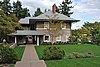 | October 13, 1988 (#88001039) | 11648 SW Military Lane 45°26′29″N 122°39′08″W / 45.441435°N 122.652169°W / 45.441435; -122.652169 (Whidden–Kerr House and Garden) | Portland | This 1901 house and carriage house, designed by William M. Whidden for himself and his family, is the "best expression" of the Prairie School by Whidden and Lewis, one of Portland's most prominent architectural firms of the period. Whidden's extensive gardens were further developed by Thomas and Mabel Kerr after they acquired the estate in 1911.[23] |
37 | Theodore B. Wilcox Country Estate |  | February 19, 1993 (#93000019) | 3707 SW 52nd Place 45°29′46″N 122°43′46″W / 45.496238°N 122.729535°W / 45.496238; -122.729535 (Theodore B. Wilcox Country Estate) | Portland | |
38 | Jacob Zimmerman House |  | June 5, 1986 (#86001226) | 17111 NE Sandy Boulevard 45°32′55″N 122°29′14″W / 45.548621°N 122.487182°W / 45.548621; -122.487182 (Jacob Zimmerman House) | Gresham |
Former listings[edit]
| [5] | Name on the Register | Image | Date listed | Date removed | Location | City or town | Summary |
|---|---|---|---|---|---|---|---|
1 | Bethel Baptist Church | April 15, 1982[24][25] (#82003740) | April 18, 2006 | 101 S. Main Street | Gresham | ||
2 | Lewis H. Mills House | February 21, 1997[26] (#97000135) | May 24, 2010 | 1350 SW Military Road 45°26′24″N 122°39′59″W / 45.43992°N 122.6663°W / 45.43992; -122.6663 (Lewis H. Mills House) | Portland |
See also[edit]
- National Register of Historic Places listings in Oregon
- Listings in neighboring counties: Clackamas, Clark, Columbia, Hood River, Skamania, Washington
- List of National Historic Landmarks in Oregon
- Historic preservation
- History of Oregon
- Lists of Oregon-related topics
Notes[edit]
^ The Columbia River Highway Historic District is a linear district with the Sandy River Bridge, Troutdale, at its west end, and the Chenoweth Creek Bridge, The Dalles, at the east end. See also Hood River and Wasco counties.
^ Federal and state laws and practices restrict general public access to information regarding the specific location of this resource. In some cases, this is to protect archeological sites from vandalism, while in other cases it is restricted at the request of the owner.
References[edit]
^ National Park Service (1997), How to Apply the National Register Criteria for Evaluation (PDF), National Register Bulletins, retrieved December 17, 2008.mw-parser-output cite.citation{font-style:inherit}.mw-parser-output .citation q{quotes:"""""""'""'"}.mw-parser-output .citation .cs1-lock-free a{background:url("//upload.wikimedia.org/wikipedia/commons/thumb/6/65/Lock-green.svg/9px-Lock-green.svg.png")no-repeat;background-position:right .1em center}.mw-parser-output .citation .cs1-lock-limited a,.mw-parser-output .citation .cs1-lock-registration a{background:url("//upload.wikimedia.org/wikipedia/commons/thumb/d/d6/Lock-gray-alt-2.svg/9px-Lock-gray-alt-2.svg.png")no-repeat;background-position:right .1em center}.mw-parser-output .citation .cs1-lock-subscription a{background:url("//upload.wikimedia.org/wikipedia/commons/thumb/a/aa/Lock-red-alt-2.svg/9px-Lock-red-alt-2.svg.png")no-repeat;background-position:right .1em center}.mw-parser-output .cs1-subscription,.mw-parser-output .cs1-registration{color:#555}.mw-parser-output .cs1-subscription span,.mw-parser-output .cs1-registration span{border-bottom:1px dotted;cursor:help}.mw-parser-output .cs1-ws-icon a{background:url("//upload.wikimedia.org/wikipedia/commons/thumb/4/4c/Wikisource-logo.svg/12px-Wikisource-logo.svg.png")no-repeat;background-position:right .1em center}.mw-parser-output code.cs1-code{color:inherit;background:inherit;border:inherit;padding:inherit}.mw-parser-output .cs1-hidden-error{display:none;font-size:100%}.mw-parser-output .cs1-visible-error{font-size:100%}.mw-parser-output .cs1-maint{display:none;color:#33aa33;margin-left:0.3em}.mw-parser-output .cs1-subscription,.mw-parser-output .cs1-registration,.mw-parser-output .cs1-format{font-size:95%}.mw-parser-output .cs1-kern-left,.mw-parser-output .cs1-kern-wl-left{padding-left:0.2em}.mw-parser-output .cs1-kern-right,.mw-parser-output .cs1-kern-wl-right{padding-right:0.2em}.
^ National Park Service, National Register of Historic Places Program: Research, retrieved January 28, 2015.
^ Oregon Parks and Recreation Department, Oregon Historic Sites Database, retrieved August 6, 2015. Note that a simple count of National Register records in this database returns a slightly higher total than actual listings, due to duplicate records. A close reading of detailed query results is necessary to arrive at the precise count.
^ "National Register of Historic Places: Weekly List Actions". National Park Service, United States Department of the Interior. Retrieved on February 15, 2019.
^ ab Numbers represent an ordering by significant words. Various colorings, defined here, differentiate National Historic Landmarks and historic districts from other NRHP buildings, structures, sites or objects.
^ The eight-digit number below each date is the number assigned to each location in the National Register Information System database, which can be viewed by clicking the number.
^ National Park Service, National Historic Landmark Program: NHL Database, archived from the original on 2004-06-06, retrieved 2007-10-14
^ Smith, Dwight A. (October 3, 1983), National Register of Historic Places Inventory — Nomination Form: Columbia River Highway Historic District (PDF), OCLC 12786411, retrieved July 15, 2014.
^ National Park Service, National Historic Landmark Program: NHL Database, archived from the original on June 6, 2004, retrieved July 15, 2014.
^ Tess, John M. (February 26, 1996), National Register of Historic Places Registration Form: Corbett, Elliott R., House (PDF), retrieved February 14, 2013.
^ Christensen, Christina M. (December 15, 1988), National Register of Historic Places Registration Form: Gedamke, William, House (PDF), retrieved November 15, 2014.
^ Graff, Juanita (October 14, 1979), National Register of Historic Places Inventory—Nomination Form: Graf (Andreas) House (PDF), retrieved October 27, 2014.
^ City of Portland, PortlandMaps, retrieved November 15, 2014.
^ Smith, Valerie Taylor; Kaser, Cara (November 2010), National Register of Historic Places Registration Form: Jacobberger, Joseph, Country House (PDF), retrieved March 22, 2013.
^ Keizur, Christopher (October 25, 2017). "A legacy of providing aid to the most vulnerable". The Outlook. Gresham, Oregon: Pamplin Media Group. Retrieved March 27, 2018.
^ Olson, Gregg (April 29, 2007), National Register of Historic Places Registration Form: Olson, Charles and Fae, House (PDF), retrieved September 26, 2014.
^ Franzen, Robin (May 26, 2008), "Building their American dream in a time of war", The Oregonian, Portland, retrieved September 26, 2014.
^ Stuart, Patience (July 2011), National Register of Historic Places Registration Form: Springdale School (PDF), retrieved March 17, 2012.
^ Knoerl, John; Miller, Diane; Shrimpton, Rebecca H. (1990), Guidelines for Restricting Information about Historic and Prehistoric Resources, National Register Bulletin (29), National Park Service, U.S. Department of the Interior, OCLC 20706997.
^ National Park Service, National Historic Landmark Program: NHL Database, archived from the original on June 6, 2004, retrieved October 19, 2007
^ Bogan, David (2006), "Sauvie Island's "Sunken Village" - A Special Place Forever Preserved?" (PDF), Cultural Heritage Courier, 2006 (2).
^ Dodds, Linda (June 30, 1984), National Register of Historic Places Inventory — Nomination Form: View Point Inn (PDF), National Park Service, retrieved September 29, 2013
^ Demuth, Kimberly; Lakin, Kimberly (August 15, 1987), National Register of Historic Places Registration Form: Whidden-Kerr House and Garden (PDF), retrieved September 27, 2013.
^ "Bethel Baptist Church (Gresham, Oregon)". Oregon State Historic Preservation Office / University of Oregon. Retrieved September 29, 2013.
^ "National Park Service: National Register of Historic Places; Annual Listing of Historic Properties" (PDF). 48 (1). Federal Register. March 1, 1983: 8659. Retrieved September 29, 2013.
^ "Weekly List of Actions Taken on Properties: 2/17/97 Through 2/21/97". National Park Service. February 28, 1997. Retrieved September 29, 2013.
External links[edit]
- Oregon Parks and Recreation Department, National Register Program
- National Park Service, National Register of Historic Places site
 Media related to National Register of Historic Places in Multnomah County, Oregon at Wikimedia Commons
U.S. National Register of Historic Places in Oregon | ||
|---|---|---|
| Lists by county |
|   |
Portland lists |
| |
| Other lists |
| |
| ||
U.S. National Register of Historic Places | |
|---|---|
| Topics |
|
| Lists by state |
|
| Lists by insular areas |
|
| Lists by associated state |
|
| Other areas |
|
| |
Municipalities and communities of Multnomah County, Oregon, United States | ||
|---|---|---|
County seat: Portland | ||
| Cities |
|  |
| Unincorporated communities |
| |
| Footnotes | ‡This populated place also has portions in an adjacent county or counties | |
Categories:
- National Register of Historic Places in Multnomah County, Oregon
- Lists of National Register of Historic Places in Oregon by county
(window.RLQ=window.RLQ||).push(function(){mw.config.set({"wgPageParseReport":{"limitreport":{"cputime":"1.044","walltime":"1.323","ppvisitednodes":{"value":17197,"limit":1000000},"ppgeneratednodes":{"value":0,"limit":1500000},"postexpandincludesize":{"value":379400,"limit":2097152},"templateargumentsize":{"value":28875,"limit":2097152},"expansiondepth":{"value":12,"limit":40},"expensivefunctioncount":{"value":4,"limit":500},"unstrip-depth":{"value":1,"limit":20},"unstrip-size":{"value":76195,"limit":5000000},"entityaccesscount":{"value":2,"limit":400},"timingprofile":["100.00% 861.488 1 -total"," 57.97% 499.428 40 Template:NRHP_row"," 24.37% 209.965 19 Template:Citation"," 17.84% 153.648 2 Template:Reflist"," 16.27% 140.125 1 Template:Address_restricted"," 13.99% 120.518 1 Template:Address_restricted/Reference_note"," 13.50% 116.279 1 Template:NRORextlinks"," 8.52% 73.357 78 Template:First_word"," 8.48% 73.022 50 Template:NRHP_color"," 8.16% 70.277 42 Template:Dts"]},"scribunto":{"limitreport-timeusage":{"value":"0.360","limit":"10.000"},"limitreport-memusage":{"value":5292442,"limit":52428800}},"cachereport":{"origin":"mw1325","timestamp":"20190222064834","ttl":2073600,"transientcontent":false}}});mw.config.set({"wgBackendResponseTime":102,"wgHostname":"mw1265"});});


