National Register of Historic Places listings in Calaveras County, California
National Register of Historic Places listings in Calaveras County, California
Jump to navigation
Jump to search

Location of Calaveras County in California
This is a list of the National Register of Historic Places listings in Calaveras County, California.
This is intended to be a complete list of the properties and districts on the National Register of Historic Places in Calaveras County, California, United States. Latitude and longitude coordinates are provided for many National Register properties and districts; these locations may be seen together in a Google map.[1]
There are 16 properties and districts listed on the National Register in the county.
This National Park Service list is complete through NPS recent listings posted April 12, 2019.[2]
Current listings[edit]
| [3] | Name on the Register[4] | Image | Date listed[5] | Location | City or town | Description |
|---|---|---|---|---|---|---|
1 | Altaville Grammar School |  | August 24, 1979 (#79000471) | 125 N. Main St. 38°04′58″N 120°33′39″W / 38.082778°N 120.560833°W / 38.082778; -120.560833 (Altaville Grammar School) | Altaville | |
2 | Angels Hotel |  | March 24, 1972 (#72000220) | Main St. at Birds Way 38°04′08″N 120°32′44″W / 38.068889°N 120.545556°W / 38.068889; -120.545556 (Angels Hotel) | Angels Camp | |
3 | Calaveras County Bank |  | August 1, 1985 (#85001683) | 1239 Main St. 38°04′11″N 120°32′22″W / 38.069722°N 120.539444°W / 38.069722; -120.539444 (Calaveras County Bank) | Angels Camp | |
4 | Calaveras County Courthouse | 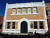 | February 28, 1972 (#72000221) | Main St. 38°11′48″N 120°40′45″W / 38.196667°N 120.679167°W / 38.196667; -120.679167 (Calaveras County Courthouse) | San Andreas | |
5 | Calaveritas Creek Bridge | November 6, 2015 (#15000767) | Calaveritas Rd. at Calaveritas Cr. 38°09′22″N 120°36′35″W / 38.1562°N 120.6098°W / 38.1562; -120.6098 (Calaveritas Creek Bridge) | Calaveritas | ||
6 | Sam Choy Brick Store | 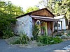 | September 20, 1984 (#84000759) | Bird Way 38°04′09″N 120°32′18″W / 38.069167°N 120.538333°W / 38.069167; -120.538333 (Sam Choy Brick Store) | Angels Camp | |
7 | Copperopolis Armory |  | December 30, 1997 (#97001588) | 695 Main St. 37°58′34″N 120°38′04″W / 37.976111°N 120.634444°W / 37.976111; -120.634444 (Copperopolis Armory) | Copperopolis | |
8 | Copperopolis Congregational Church |  | December 30, 1997 (#97001587) | 411 Main St. 37°58′47″N 120°38′16″W / 37.979722°N 120.637778°W / 37.979722; -120.637778 (Copperopolis Congregational Church) | Copperopolis | |
9 | Douglas Flat School |  | May 24, 1973 (#73000397) | NE of Vallecito on SR 4 38°07′01″N 120°27′11″W / 38.116944°N 120.453056°W / 38.116944; -120.453056 (Douglas Flat School) | Douglas Flat | |
10 | Honigsberger Store |  | April 2, 1992 (#92000310) | 665 Main St. 37°58′34″N 120°38′07″W / 37.976111°N 120.635278°W / 37.976111; -120.635278 (Honigsberger Store) | Copperopolis | |
11 | Murphys Grammar School |  | June 8, 1973 (#73000398) | Jones St. 38°08′08″N 120°27′24″W / 38.135556°N 120.456667°W / 38.135556; -120.456667 (Murphys Grammar School) | Murphys | |
12 | Murphys Hotel |  | November 23, 1971 (#71000134) | Main and Algiers Sts. 38°08′15″N 120°27′50″W / 38.1375°N 120.463889°W / 38.1375; -120.463889 (Murphys Hotel) | Murphys | Also known as Mitchler Hotel |
13 | Reed's Store |  | April 2, 1992 (#92000309) | 679 Main St. 37°58′34″N 120°38′05″W / 37.976111°N 120.634722°W / 37.976111; -120.634722 (Reed's Store) | Copperopolis | |
14 | John J. Snyder House |  | August 2, 1984 (#84000760) | 247 W. St. Charles St. 38°11′51″N 120°41′06″W / 38.1975°N 120.685°W / 38.1975; -120.685 (John J. Snyder House) | San Andreas | |
15 | Thorn House |  | February 23, 1972 (#72000222) | 87 E. St. Charles St. 38°11′43″N 120°40′40″W / 38.195278°N 120.677778°W / 38.195278; -120.677778 (Thorn House) | San Andreas | |
16 | Utica Mansion |  | May 31, 1984 (#84000764) | 1103 Bush St. 38°04′16″N 120°32′32″W / 38.071111°N 120.542222°W / 38.071111; -120.542222 (Utica Mansion) | Angels Camp |
See also[edit]
| Wikimedia Commons has media related to National Register of Historic Places in Calaveras County, California. |
- List of National Historic Landmarks in California
- National Register of Historic Places listings in California
- California Historical Landmarks in Calaveras County, California
References[edit]
^ The latitude and longitude information provided in this table was derived originally from the National Register Information System, which has been found to be fairly accurate for about 99% of listings. For about 1% of NRIS original coordinates, experience has shown that one or both coordinates are typos or otherwise extremely far off; some corrections may have been made. A more subtle problem causes many locations to be off by up to 150 yards, depending on location in the country: most NRIS coordinates were derived from tracing out latitude and longitudes from USGS topographical quadrant maps created under the North American Datum of 1927, which differs from the current, highly accurate WGS84 GPS system used by most on-line maps. Chicago is about right, but NRIS longitudes in Washington are higher by about 4.5 seconds, and are lower by about 2.0 seconds in Maine. Latitudes differ by about 1.0 second in Florida. Some locations in this table may have been corrected to current GPS standards.
^ "National Register of Historic Places: Weekly List Actions". National Park Service, United States Department of the Interior. Retrieved on April 12, 2019.
^ Numbers represent an ordering by significant words. Various colorings, defined here, differentiate National Historic Landmarks and historic districts from other NRHP buildings, structures, sites or objects.
^ National Park Service (2010-07-09). "National Register Information System". National Register of Historic Places. National Park Service..mw-parser-output cite.citation{font-style:inherit}.mw-parser-output .citation q{quotes:"""""""'""'"}.mw-parser-output .citation .cs1-lock-free a{background:url("//upload.wikimedia.org/wikipedia/commons/thumb/6/65/Lock-green.svg/9px-Lock-green.svg.png")no-repeat;background-position:right .1em center}.mw-parser-output .citation .cs1-lock-limited a,.mw-parser-output .citation .cs1-lock-registration a{background:url("//upload.wikimedia.org/wikipedia/commons/thumb/d/d6/Lock-gray-alt-2.svg/9px-Lock-gray-alt-2.svg.png")no-repeat;background-position:right .1em center}.mw-parser-output .citation .cs1-lock-subscription a{background:url("//upload.wikimedia.org/wikipedia/commons/thumb/a/aa/Lock-red-alt-2.svg/9px-Lock-red-alt-2.svg.png")no-repeat;background-position:right .1em center}.mw-parser-output .cs1-subscription,.mw-parser-output .cs1-registration{color:#555}.mw-parser-output .cs1-subscription span,.mw-parser-output .cs1-registration span{border-bottom:1px dotted;cursor:help}.mw-parser-output .cs1-ws-icon a{background:url("//upload.wikimedia.org/wikipedia/commons/thumb/4/4c/Wikisource-logo.svg/12px-Wikisource-logo.svg.png")no-repeat;background-position:right .1em center}.mw-parser-output code.cs1-code{color:inherit;background:inherit;border:inherit;padding:inherit}.mw-parser-output .cs1-hidden-error{display:none;font-size:100%}.mw-parser-output .cs1-visible-error{font-size:100%}.mw-parser-output .cs1-maint{display:none;color:#33aa33;margin-left:0.3em}.mw-parser-output .cs1-subscription,.mw-parser-output .cs1-registration,.mw-parser-output .cs1-format{font-size:95%}.mw-parser-output .cs1-kern-left,.mw-parser-output .cs1-kern-wl-left{padding-left:0.2em}.mw-parser-output .cs1-kern-right,.mw-parser-output .cs1-kern-wl-right{padding-right:0.2em}
^ The eight-digit number below each date is the number assigned to each location in the National Register Information System database, which can be viewed by clicking the number.
U.S. National Register of Historic Places | |
|---|---|
| Topics |
|
| Lists by state |
|
| Lists by insular areas |
|
| Lists by associated state |
|
| Other areas |
|
| |
Municipalities and communities of Calaveras County, California, United States | ||
|---|---|---|
County seat: San Andreas | ||
| City |
|  |
| CDPs |
| |
| Unincorporated communities |
| |
| Former settlements |
| |
Categories:
- National Register of Historic Places in Calaveras County, California
- Lists of National Register of Historic Places in California by county
(window.RLQ=window.RLQ||).push(function(){mw.config.set({"wgPageParseReport":{"limitreport":{"cputime":"0.496","walltime":"0.635","ppvisitednodes":{"value":6992,"limit":1000000},"ppgeneratednodes":{"value":0,"limit":1500000},"postexpandincludesize":{"value":158846,"limit":2097152},"templateargumentsize":{"value":14452,"limit":2097152},"expansiondepth":{"value":11,"limit":40},"expensivefunctioncount":{"value":1,"limit":500},"unstrip-depth":{"value":1,"limit":20},"unstrip-size":{"value":5856,"limit":5000000},"entityaccesscount":{"value":0,"limit":400},"timingprofile":["100.00% 407.786 1 -total"," 41.04% 167.351 16 Template:NRHP_row"," 29.83% 121.659 1 Template:NRHP_header"," 24.26% 98.921 1 Template:NRISref"," 23.45% 95.611 1 Template:Cite_web"," 11.15% 45.483 23 Template:NRHP_color"," 10.27% 41.878 17 Template:Designation/color"," 10.01% 40.803 1 Template:Commons_category"," 8.91% 36.330 33 Template:First_word"," 8.60% 35.080 16 Template:Coord"]},"scribunto":{"limitreport-timeusage":{"value":"0.153","limit":"10.000"},"limitreport-memusage":{"value":3528810,"limit":52428800}},"cachereport":{"origin":"mw1273","timestamp":"20190420215904","ttl":2592000,"transientcontent":false}}});mw.config.set({"wgBackendResponseTime":84,"wgHostname":"mw1327"});});


